Leederville
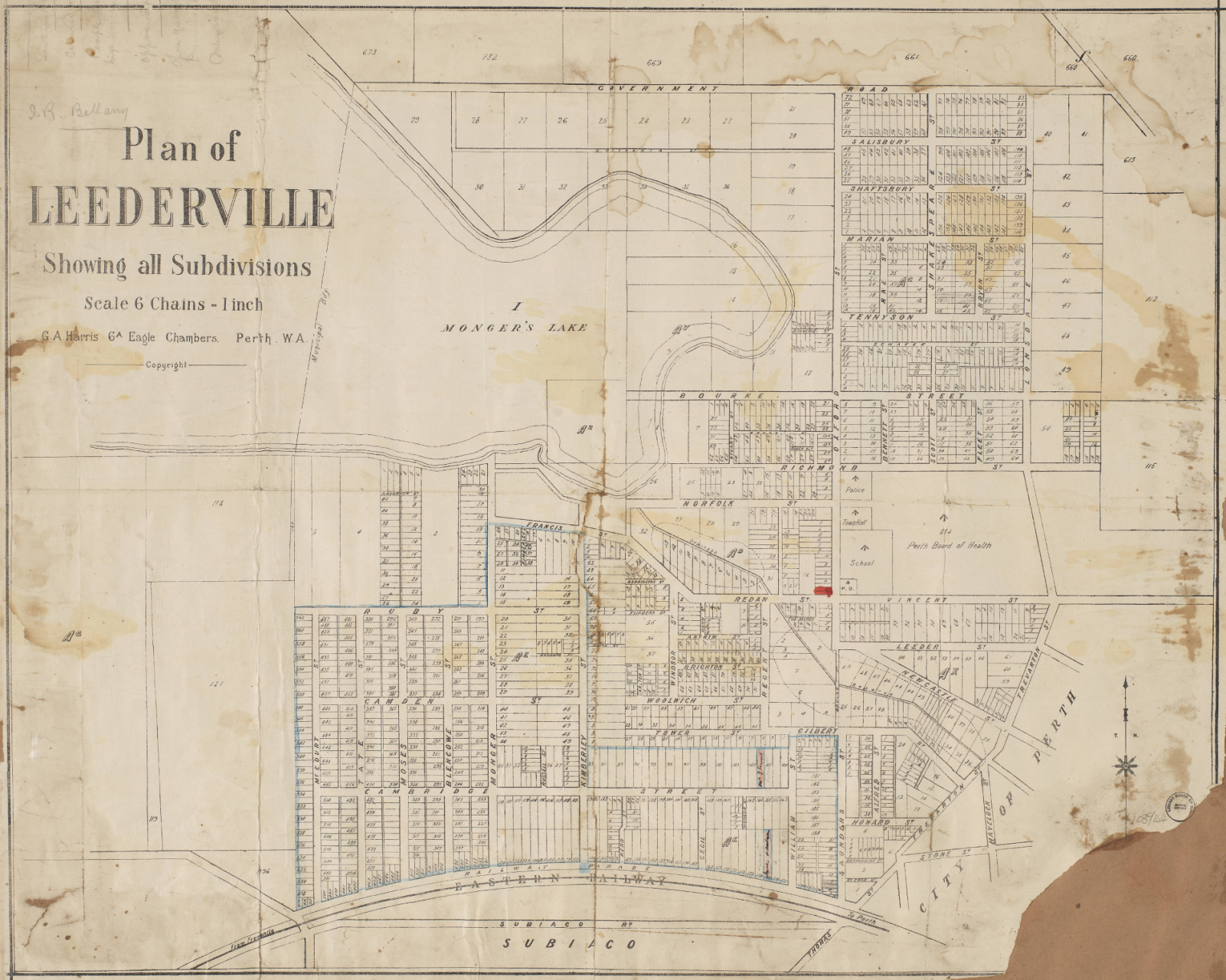
Plan of Leederville, c.1897 (City of Vincent Local History Archive)
Leederville was named after William Leeder who arrived in the Swan River Colony in 1830 and was granted land in the area around Galup. The lake was originally much larger than the present day Galup which Europeans first called Triangle Lake, then Monger’s Lake, and then Lake Monger until 2025, when it was renamed Galup.
To the Whadjuk Noongar people, Galup (Kaarlup) referred to both the lake and the area around it, and meant ‘place of fires.’ It was used for food gathering, camping and for meetings and ceremonies. At the time of colonisation, the land was the domain of Yellagonga and his group.
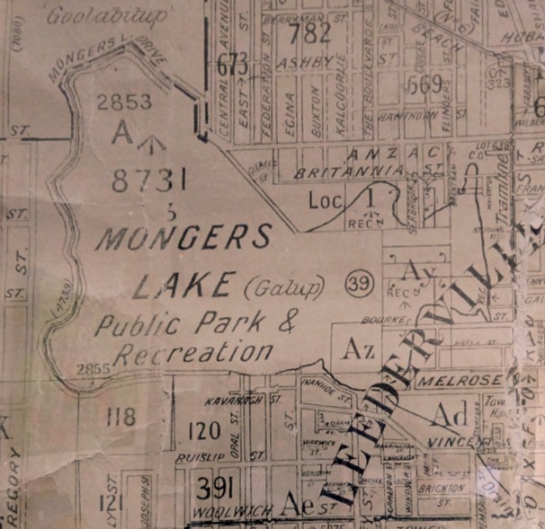
Excerpt from Perth Chain Map (40 Chain), 1922 (SLWA)
In the early colonial period in 1830, Galup/Monger’s Lake was the site of conflict and co-existence between Europeans and the Whadjuk Noongar people (See: Galup/Truth). In 1832, the colonial government established a government food depot to encourage Yellagonga’s group to camp near Monger’s Lake, rather than their preferred campsite at the foot of Mt Eliza which had been taken over by the Swan River colonists.
However, Noongar people continued to camp in the vicinity of Galup and use the lake’s resources until the 1920s and 1940s, long after the original land holders John Henry Monger and William Leeder had moved on to greener pastures in York and Toodyay.
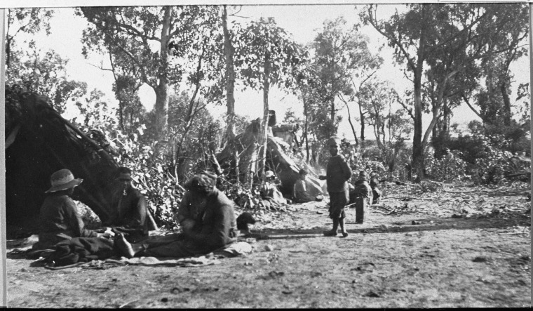
Aboriginal camp at Lake Monger north of Grantham Street Wembley, 1923 (SLWA NR-0002957)
Early farmers were attracted to the area because of its proximity to Perth and the existence of a permanent fresh water supply. Development of the land around Monger's Lake by European colonists proceeded slowly until the late 1800s. Mid-century, an influx of convict labour (who helped drain wetland areas around Perth including Lake Georgianna, south of present day Leederville Oval) stimulated growth in the colony. As the population and demand for food increased, the wetlands and surrounding areas north of Perth were used for market gardens, dairy and poultry farms.
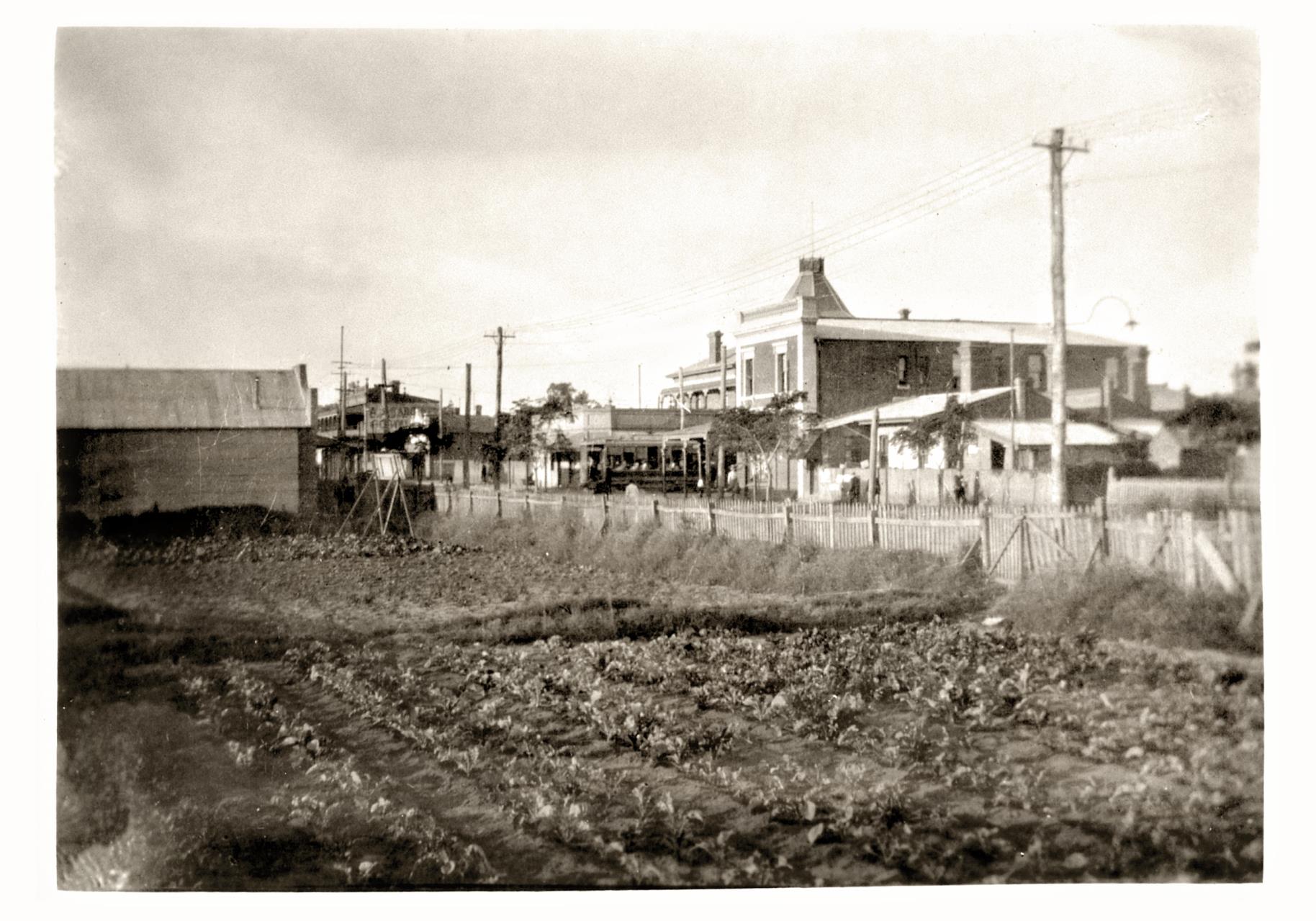
Chinese market gardens at 101-115 Oxford Street, Leederville, c.1919 (COV PHO2236)
In the late 19th century, two factors re-shaped the pattern of settlement in Leederville. The first was the completion of the Fremantle to Guildford railway in 1881 and the second was gold boom of the late 1890s, which resulted in a huge boost to the state’s population and wealth.
Land close to Perth, including the vast Leeder Estate, which made up about 75% of the present suburb of Leederville, was subdivided and sold as residential lots. Promoted under names like Leeder Estate, Lake View Estate and Leederville Station Estate, advertisements stressed the special features of the area, its proximity to Perth, Lake Monger and later the Leederville train station (now West Leederville train station).
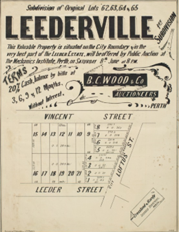
Real estate plan of Leederville, 1895. (SLWA b5143565_2)
In 1895, Leederville was declared as a Roads Board District and became a Municipality in 1896. During this period, many public and commercial buildings were built including Leederville Primary School (1894), Leederville Post Office (1897), the Leederville Hotel (1897) and the Leederville Police Station (1898). In 1900, development in Leederville was hastened by the construction and operation of a tramline from the city. Electrification for the tram network opened the way for local businesses and industries to benefit from electric power.
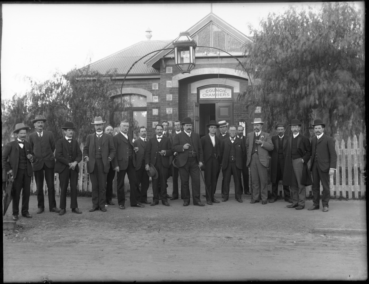
Premier’s Visit to Leederville Council on Oxford Street Leederville, 1907 (SLWA 0099979PD)
The late 1890s and early 1900s also saw the construction and expansion civic and recreation amenities. In 1903, Lake Monger was made a public reserve. Another government reserve was created between Vincent and Richmond Streets, the western end of which became Leederville Oval with tennis courts and cycle tracks as well as football facilities.
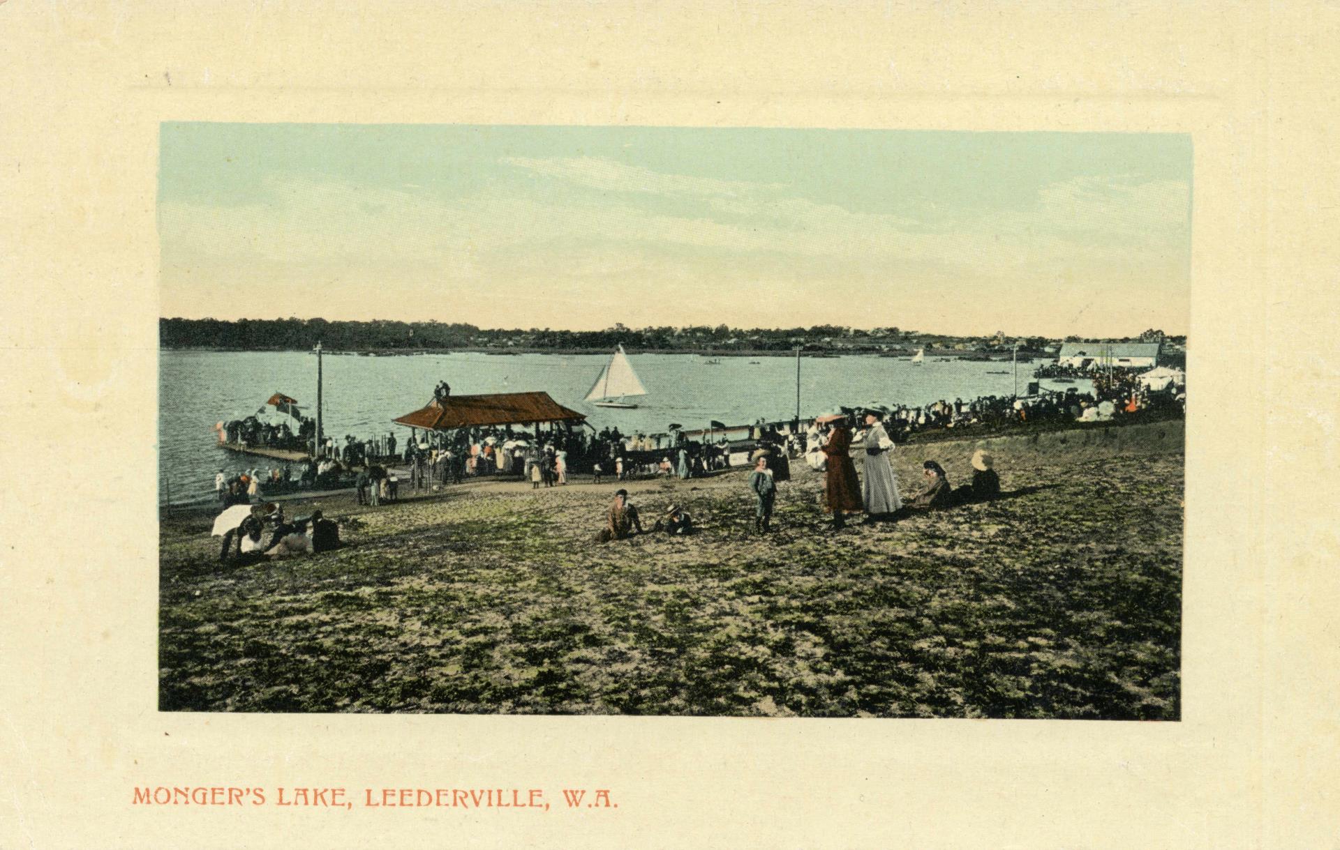
Postcard of Monger’s Lake, c.1910 (COV PHO6130)
In 1914, when the Perth, North Perth and Leederville municipalities came together to form greater Perth, Leederville had a mix of residential, commercial and industrial buildings, well established roads and transport corridors, piped water (installed in 1911) and good public amenities and recreational facilities.
In the inter-war period, Saint Mary’s Church Leederville was built in 1923 on the site of the old Leeder family homestead. In the 1920s theatre going and watching the ‘talkies’ were popular, one of the earliest venues being the New Oxford Theatre (now the Luna Cinema), built in 1927.
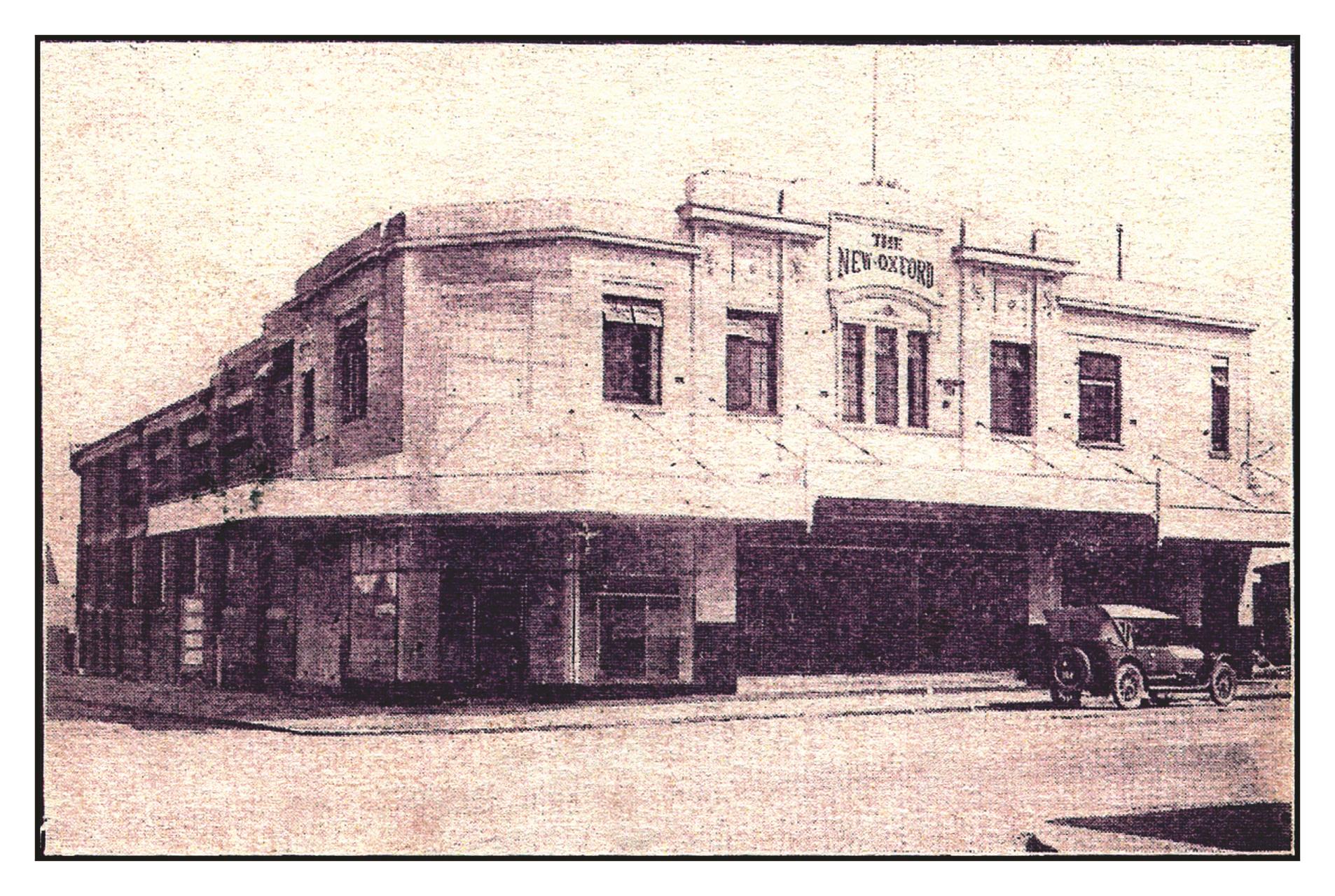
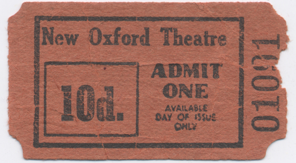
New Oxford Theatre at 155-159 Oxford Street, 1927 (COV PHO3077) New Oxford Theatre ticket stub, 1960s (COV PHO3077n)
Following a relatively stagnant period of the Great Depression, followed by war, the suburb grew again after WWII, with post-war immigration increasing demand for new and improved housing and commercial buildings in the area. New shops and office buildings replaced many of the older residences around Oxford and Newcastle Streets.
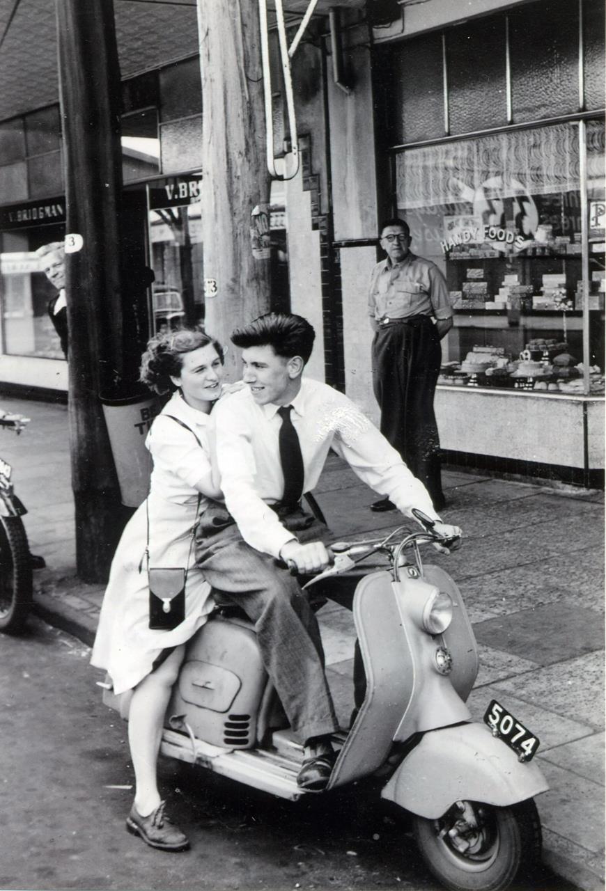
Couple on scooter outside 145 Oxford Street, Leederville, 1952. (COV PHO1666)
In 1948, a technical and trades school was built in Leederville as part of an Army training scheme. This later became known as the Leederville TAFE (currently North Metro TAFE).
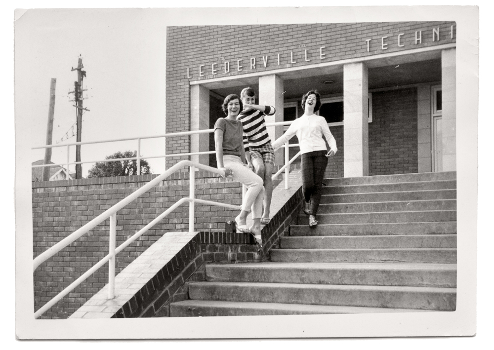
Tilbrook sisters at Leederville Technical School, 1960 (COV PHO3493)
Transport also changed in the post-war period with trams and trolleybuses replaced in the 1960s by buses and cars.
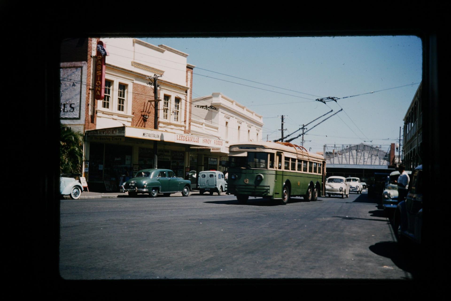
Trolley bus travelling east along Newcastle Street, Leederville, 1959 (COV PHO3148)
In 1973, the construction of the Mitchell Freeway saw the suburb of Leederville cut in half, with creation of a physical barrier to accessing Lake Monger from the east. In the same decade, the Western Australian Water Authority built a new administration building on the site of the old Metropolitan Waterworks Pumping Station on Newcastle Street. It was replaced in 1980 by the John Tonkin Water Centre, which remains the head office of Water Corporation.
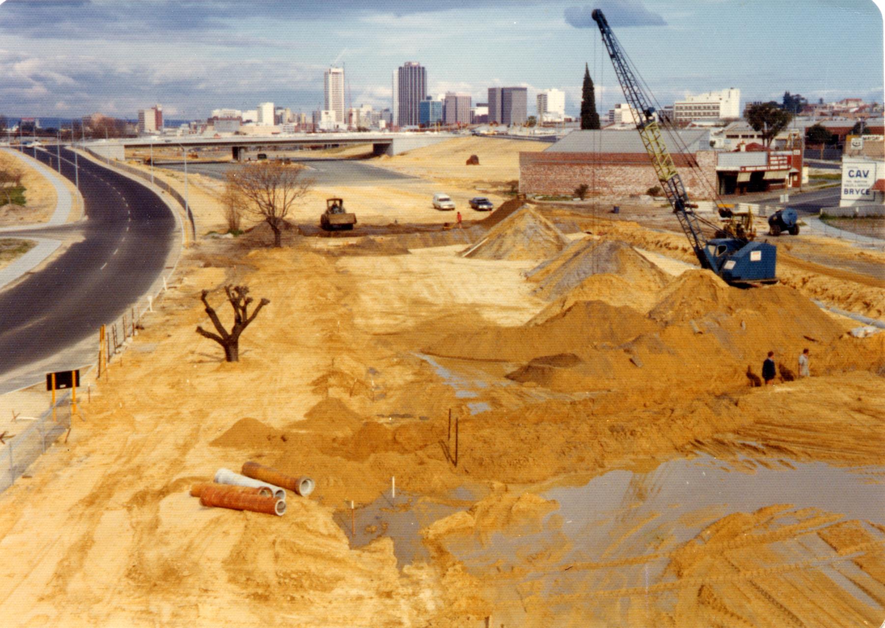
Construction of the Mitchell Freeway in Leederville, 1975 (COV PHO2577)
In the early 1990s, construction of the northern suburbs railway line had a flow-on effect for Leederville, with residents gaining easy access to rail transport at the Leederville Station at the southern end of Oxford Street. The nearby shopping area on Oxford Street was also redeveloped into a popular café strip.
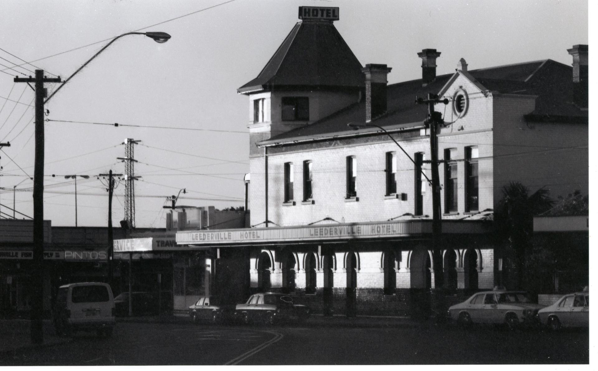
Leederville Hotel, c.1980 (COV PH06467)
In 1996, the newly created Town of Vincent built offices on the corner of Loftus and Vincent Streets, on the site of a Government Reserve (and former rubbish tip). The Vincent Administration and Civic Centre is adjacent to the Loftus Recreation and Community Centre, which opened in 1988 and was refurbished in 2008.
Today, Leederville is a bustling commercial and residential hub home to approximately 3,900 residents. Compared to other suburbs in Vincent, Leederville has a higher proportion of young people aged 18 to 34 and of overseas born people who have recently arrived from overseas. The suburb also has more medium density housing which makes up just under half of the 1,600 private dwellings in Leederville (ABS Estimated Resident Population 2022).
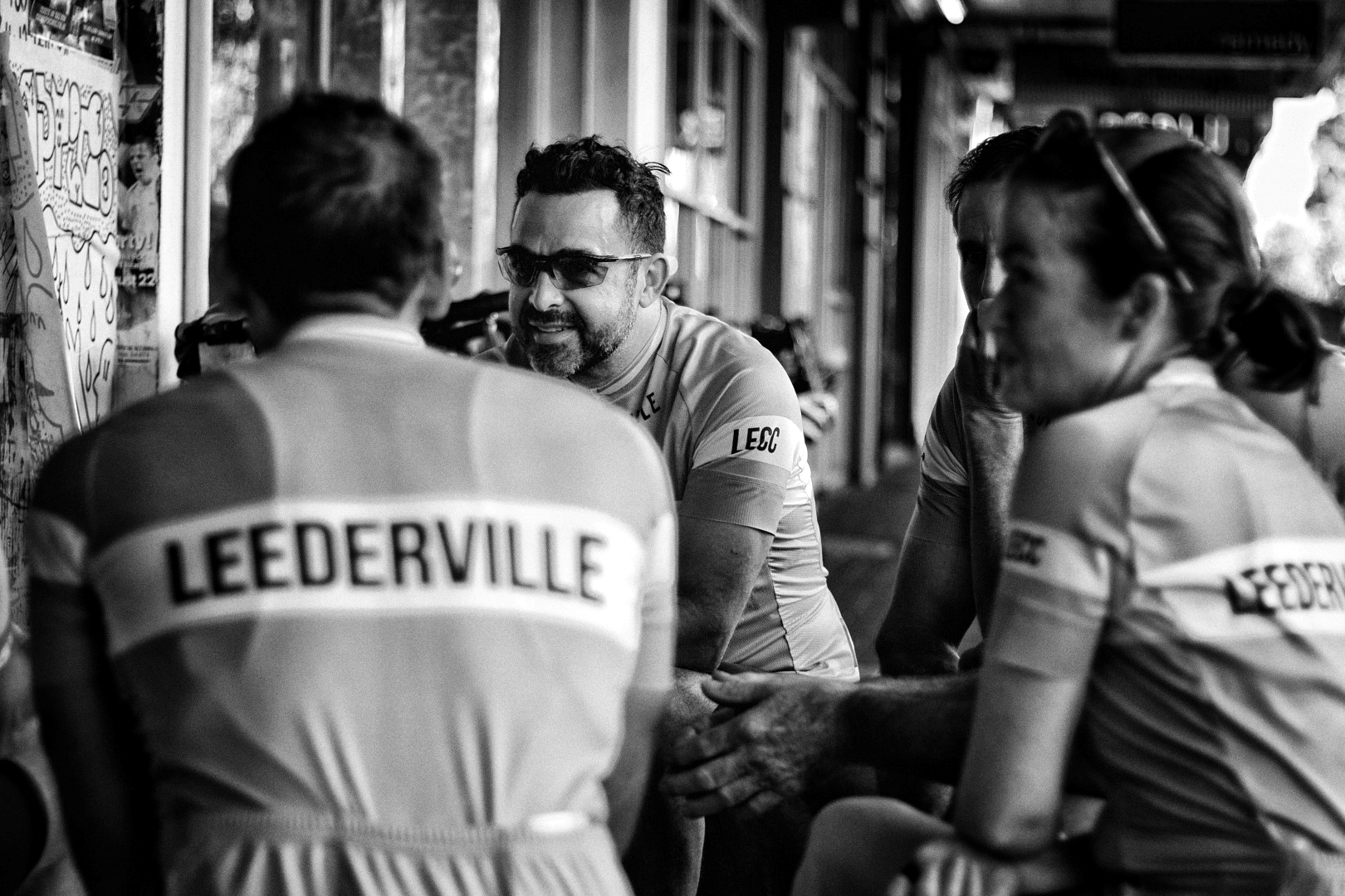
Cyclists from the Leederville Escapados Club having coffee on Oxford Street, 2018 (COV PHO5901)
For more great photos of Leederville visit the Local History Image Gallery: Leederville History Album
If you have any further information or photographs about Leederville please contact us at local.history@vincent.wa.gov.au