Various historical maps and plans of the North Perth area are available.
Maps from the 1800s
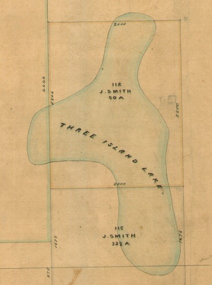
Perth town maps from the 1840s-1870s show the footprint of the former wetlands north of Perth which were eventually drained and filled. The main wetland in North Perth was located around present-day Charles Veryard Reserve. The area was known to Noongar people as Danjanberup/Janjanbering and to early colonists as ‘Three Island Lake’ and later Smith’s Lake.
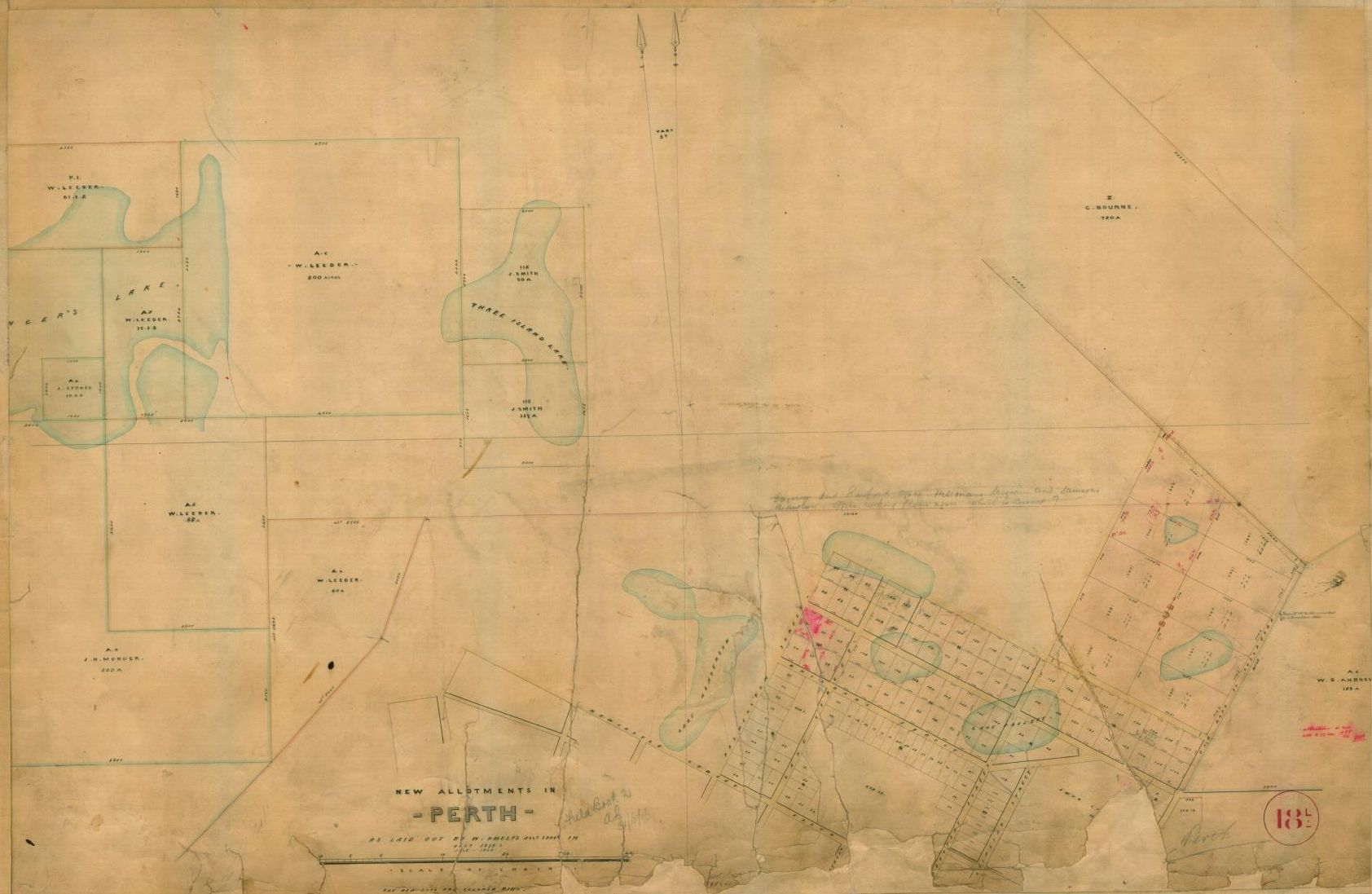
Excerpts from map of new allotments in Perth, 1858-1860 (SRO Cons_3868_item301)
Maps from the 1900s
A North Perth town map from 1910 shows the original boundaries of the municipality, which originally included much of the Mount Hawthorn area.
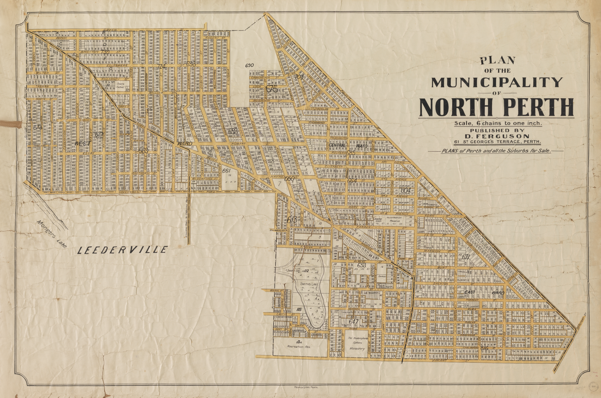
Plan of the Municipality of North Perth, c.1910 (SLWA 33/15/1e)
Some old survey (or ‘chain’ maps) of Perth included Noongar names for particular areas. The Noongar place names relevant to North Perth include: Goonderup and Danjanberup/Janjanbering.
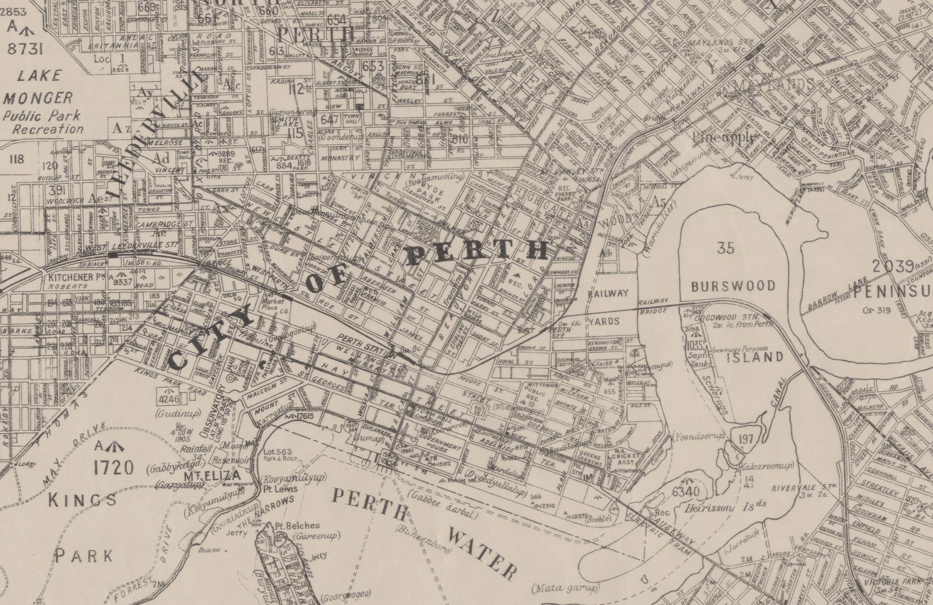
Cropped excerpt from map of Perth, 1933 (SLWA CN77 40 Chain)
Real Estate Plans
Real estate plans of the North Perth area dating from the 1890s to the 1930s show the early subdivisions in the area. There are over 30 real estate plans for North Perth. Real estate developers gave the subdivisions fancy names such as 'Toorak' and 'Woodville' and the land was advertised as being 'high and healthy.' Proximity to the city, good roads and public transport were also a selling feature. Other North Perth subdivisions included: Lakeside Estate, Christmas Hill, Forrest Hill, Lurline Park, View Park and the Monastery Grounds.
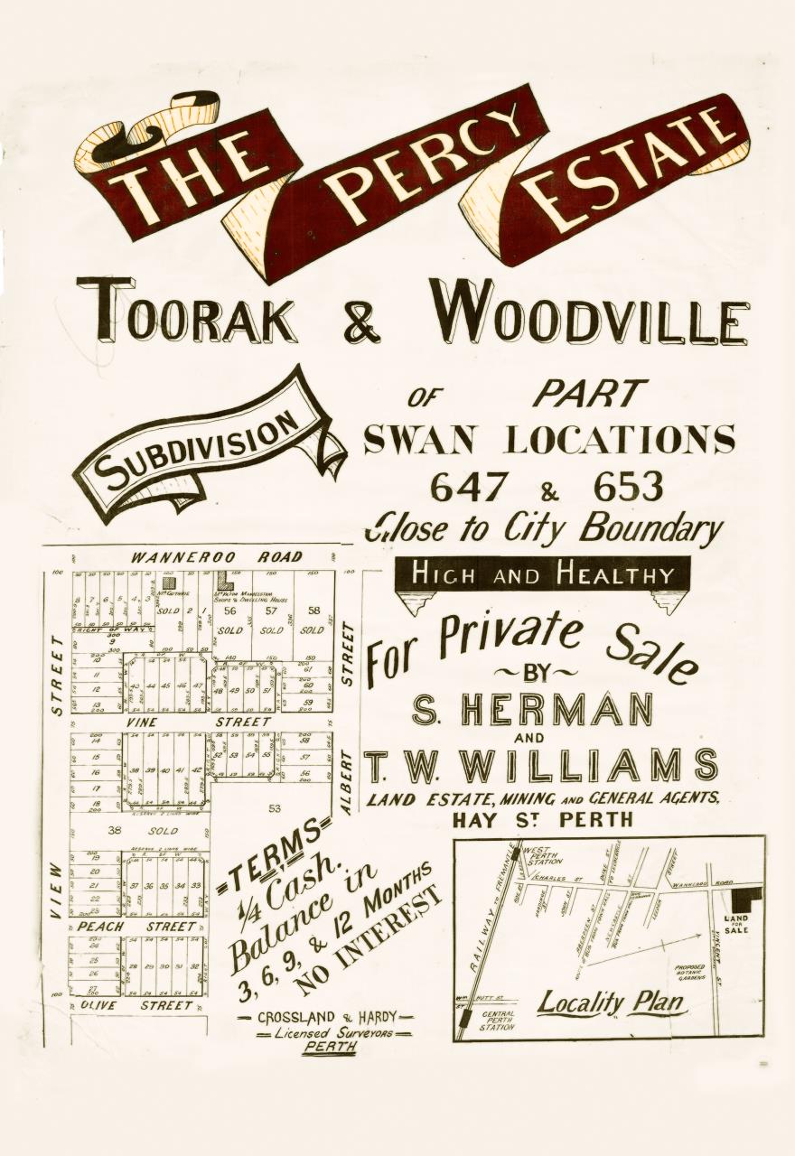
The Percy Estate, Toorak & Woodville, 1897 (SLWA 55/14/55)
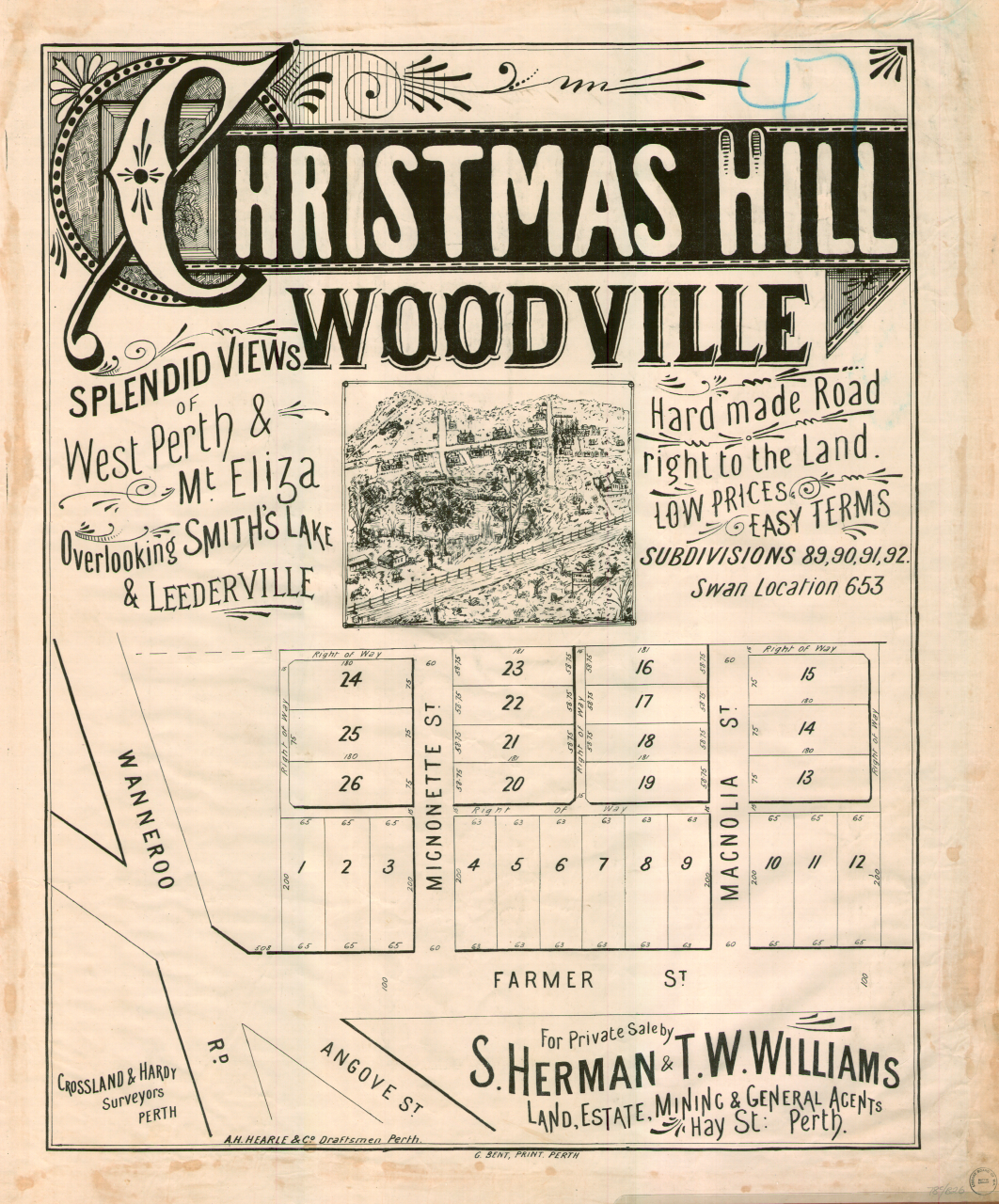
Christmas Hill Woodville, 1895 (SLWA 55/14/26)
Real estate plans for North Perth held in State Library of Western Australia
Sewerage Plans
Historical plans of particular streets or houses and buildings from the early 1900s drawn up by the Metropolitan Water Works Board to help install sewerage in Perth (‘Sewerage Plans’) show the original footprint of many streets and homes in the North Perth area. These plans are available online from the State Records office via Retromaps.
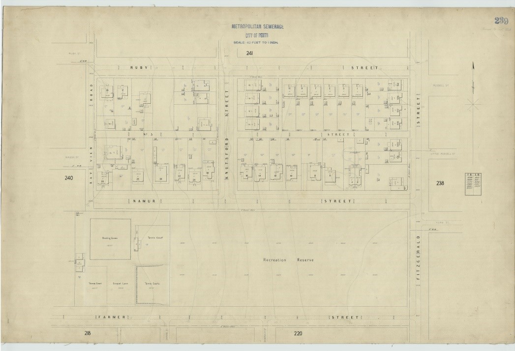
Waugh Street, North Perth, 1924 (SROWA_series634_cons4156?item0239)
Building Plans & Records
Architectural drawings of public buildings such as the North Perth Town Hall or Beatty Park are available from the State Records Office or the City of Vincent Local History Centre.
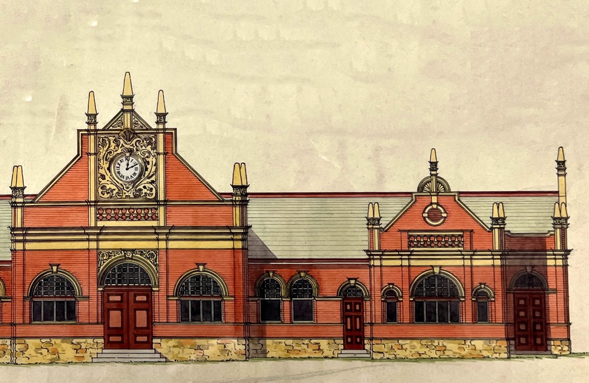
Town Hall for the Municipal Council of North Perth (State Records Office S4123-Cons 1644 035)
More information
If you are looking for a plan of a specific property, the City of Vincent holds building approvals from July 1994 onwards. The City of Perth may hold older plans or approvals for properties that were under its jurisdiction prior to it being split into four councils (including Vincent) in 1994.
To find original building plans for specific properties, you can request an Archive Search for a fee.
Landgate also holds records, including the historic Certificate of Titles for individual properties, which includes a record of former owners and may sometimes include plans or sketches.
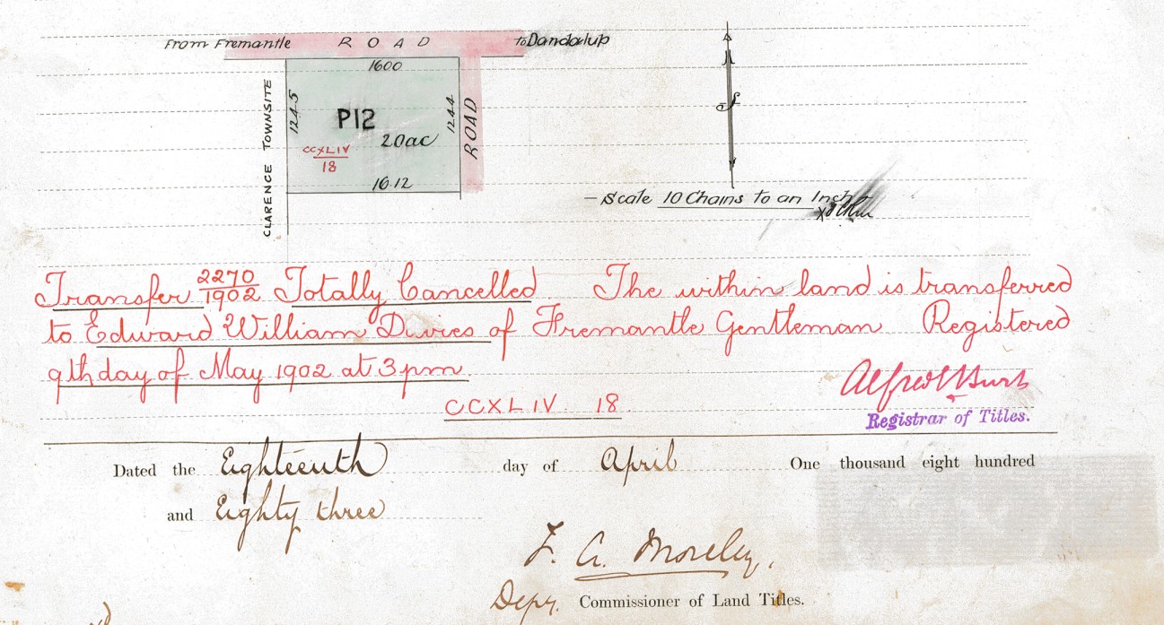
Sample of historic Certificate of Title (Landgate)