East Perth
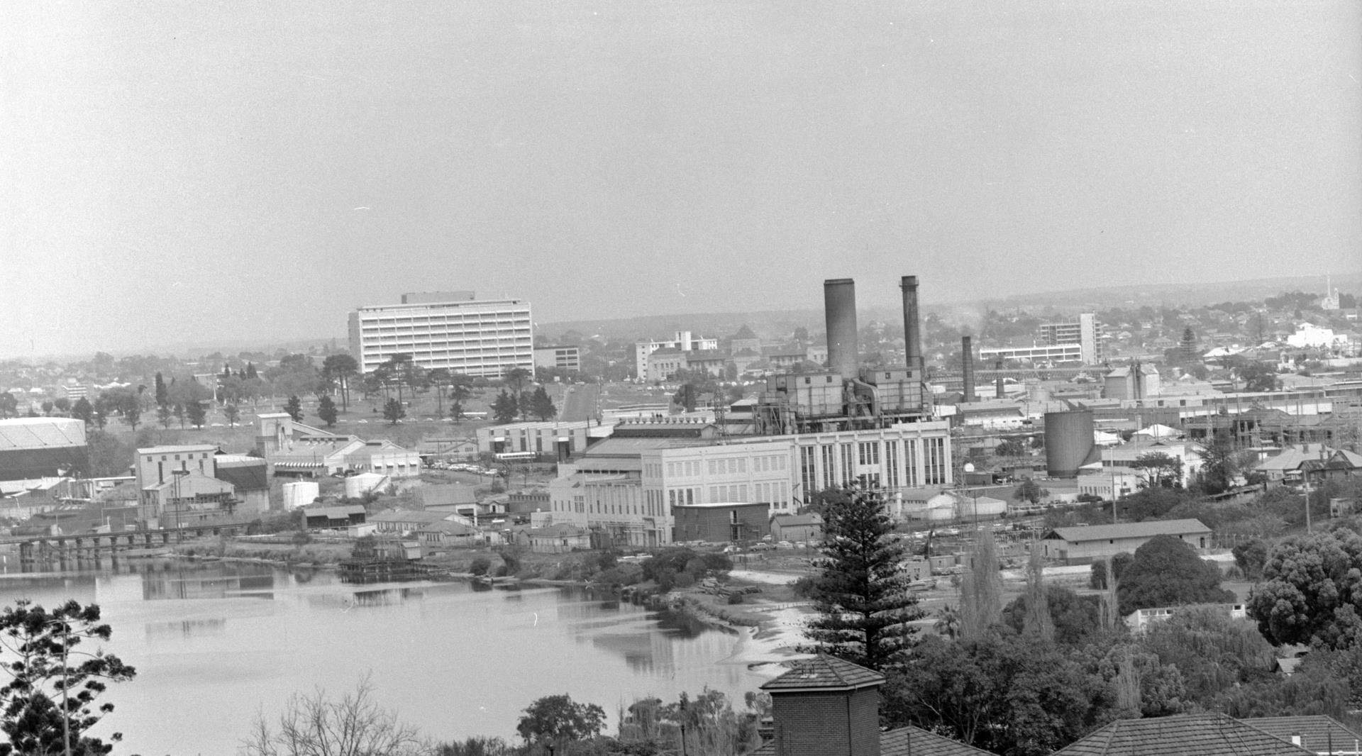
View of East Perth from St Anne’s Hospital in Mount Lawley, 1970 (SLWA, b2418862_2)
Early History
The East Perth area beside the Swan River near the Windan Bridge is a Registered Aboriginal Site (#3767) noted for its significance as a Noongar meeting place and camp site. ‘Warndoolier’ is the Noongar name that appears on early maps of the area between around present day Banks Reserve.
With European colonisation in 1829, the area was parcelled up as Swan Locations A4 and A5 and granted to Walter Boyd Andrews, who became Chair of the Perth Town Trust, and Alfred Hawes Stone, a solicitor and early photography enthusiast who was appointed the colony’s first Crown Solicitor. Another early land holder in the area was coachbuilder John Summers who became a Perth City Councilor and after whom Summers Street was named.
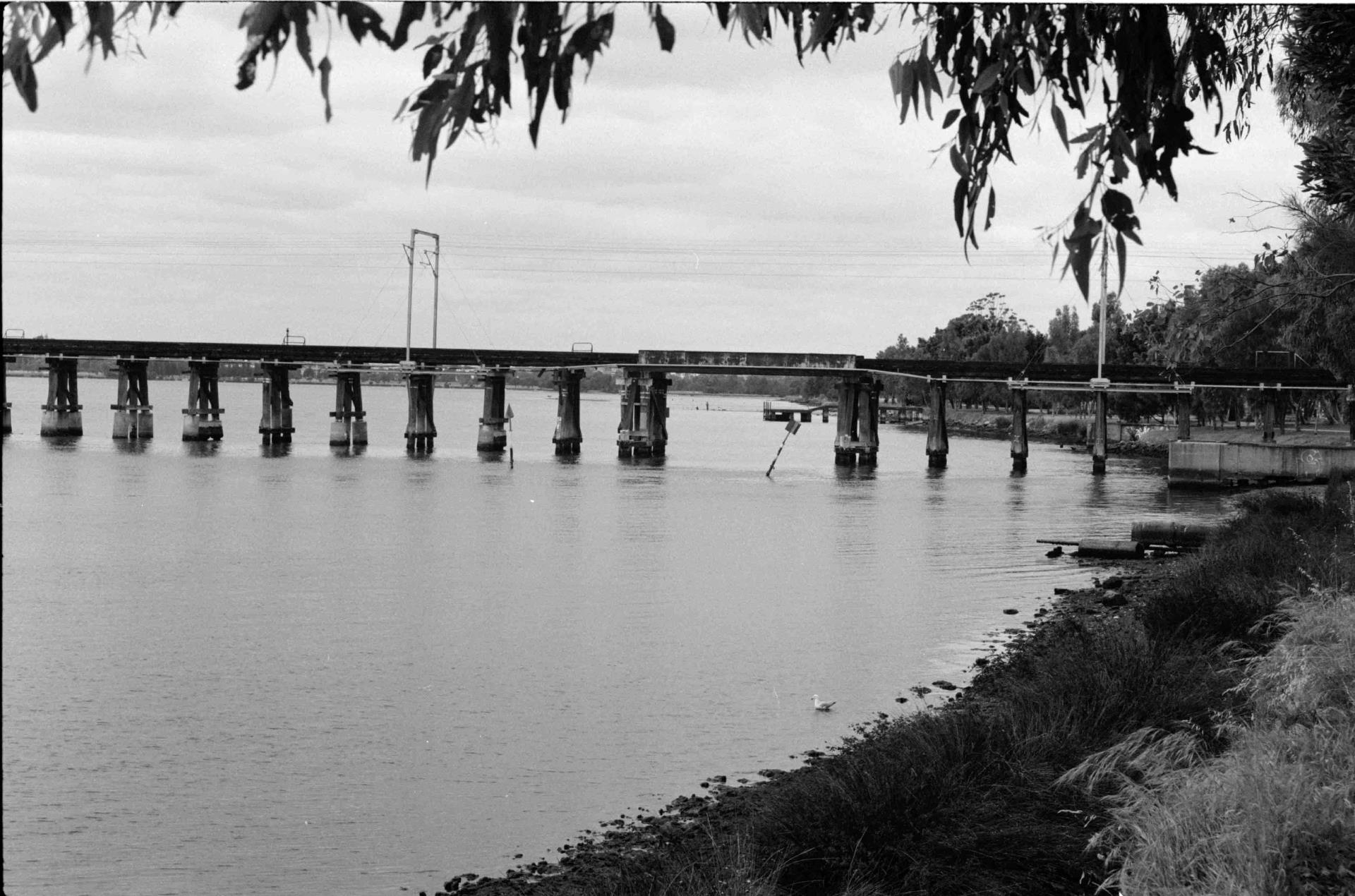
In early colonial days, the river was the main means of transportation but the track that became Lord Street and Guildford Road was an important thoroughfare for pedestrians and horses en route to Guildford. In 1881, the Fremantle to Guildford railway began operating in the area with the East Perth Station (now Claisebrook Station) opening in 1883.
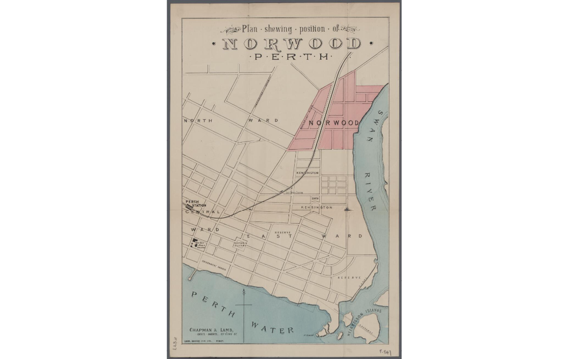
Plan showing position of Norwood, Perth (NLA, MAP F847)
1890s – 1940s
The mining and investment boom of the 1890s stimulated residential development in Perth, including the East Perth area. The area between East Parade, Summers Street, Joel Terrace and Gardiner Street was subdivided and sold as ‘East Norwood’ (east of the railway) and ‘Westralia’ estates in the 1890s. The subdivision was carried out by the Perth (WA) Estate Company. One of the company owners was Zebina Lane, an engineer and mine owner in the Great Boulder Mines who invested his mining profits into land development in Perth.
The homes in these estates attracted more affluent buyers and tenants than the more polluted, industrial area which developed around Claise Brook around the same time. Claise Brook was home to factories, saw mills, foundries and brickworks alongside poorer quality housing which attracted battlers and more transient people. The Claise Brook area was also close to the Perth sewage works, the source of noxious odours carried across the suburb on easterly winds.
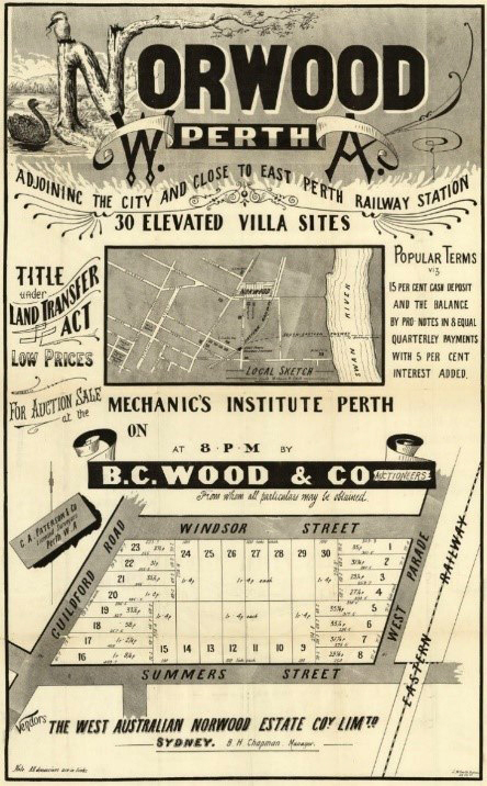
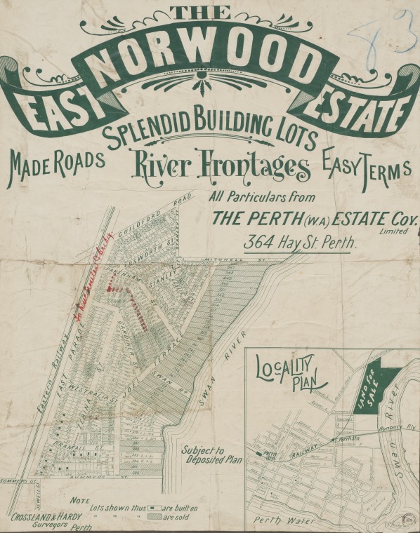
Norwood Perth, 1892. (NLA trove.nla.gov.au/work/31908217); East Norwood Estate, 1895. (SLWA_b5143637_2)
In 1916, the predominantly coal fired East Perth Power Station opened on Summers Street providing electricity for homes, factories and for Perth’s growing tram network. Between 1916 and 1951, it was the state’s only power station continuing operations until 1981.
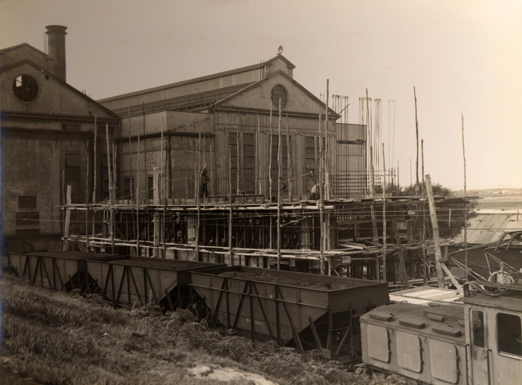
East Perth Power Station, 1936 (COV PHO1929)
In 1917, the WA Government Railways established the East Perth Locomotive Depot (also known as the ‘East Perth loco sheds’) on Summers Street. The East Perth Depot continued operating until the end of the steam railway era in the early 1970s.
The East Perth Power Station and the East Perth Depot attracted a large workforce who bought or rented homes in the area. During the Great Depression, those who found themselves unemployed and evicted from homes camped down by the river catching what they could eat in the river and brook down by Bank’s Reserve.
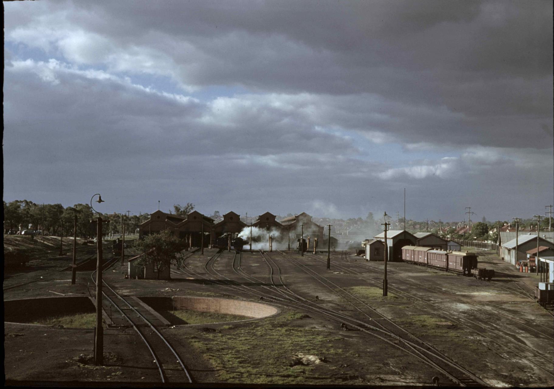
East Perth Loco Yard, 1955 (SLWA_b291179_1)
During the inter-war and early post-war periods, the area also attracted Aboriginal residents as it was on the outskirts of Perth’s Prohibited Area. Between 1927 and 1954, Aboriginal people had to carry a permit if they wanted entry to Perth for any purpose, including work. While the official boundaries of the Perth Prohibited area came down in the 1950s, the East Perth area continued to be a hub for many Aboriginal people well into the post-war period because it was close to city services and jobs and offered cheap housing or hidden places to camp.
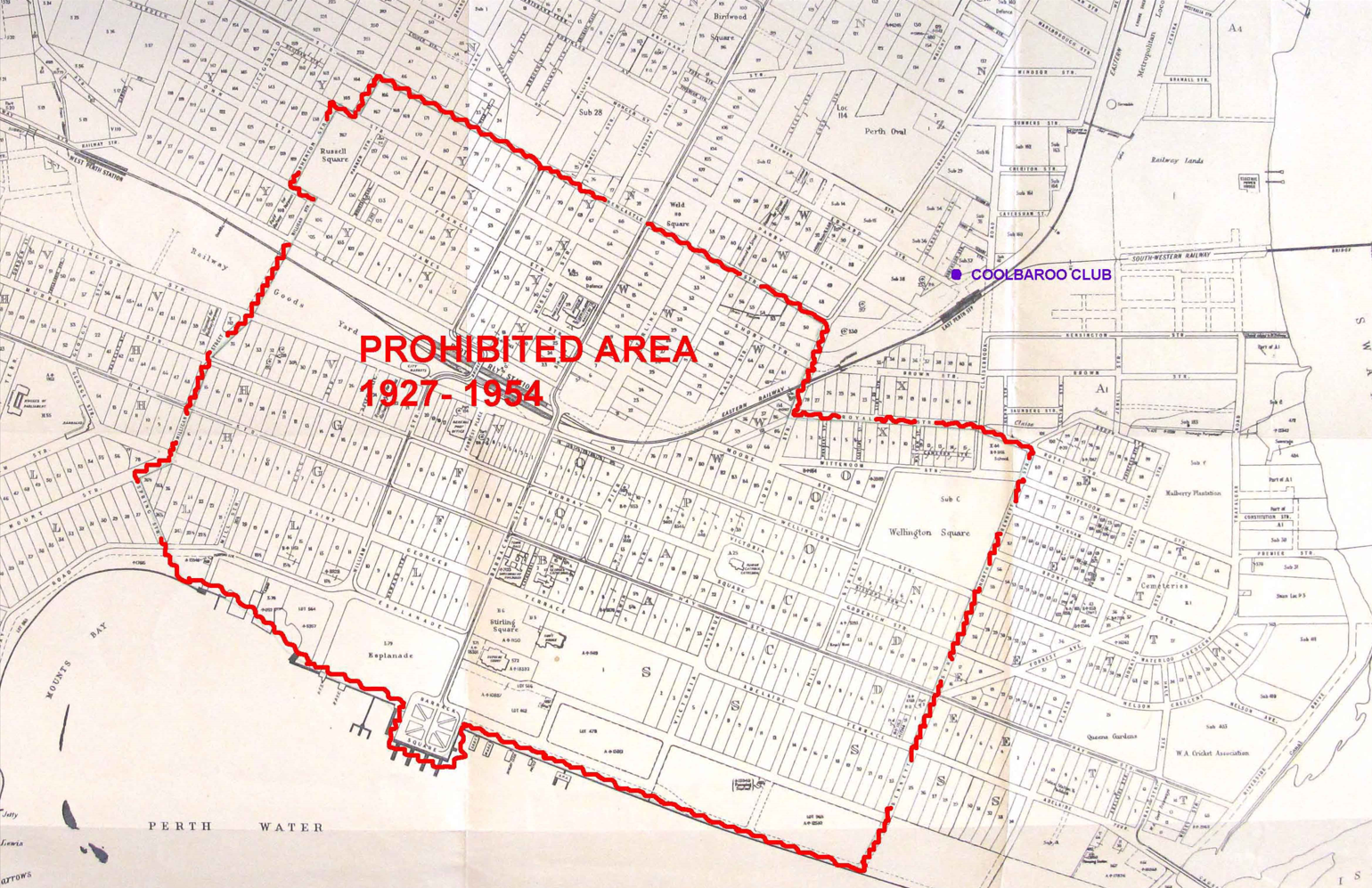
City of Perth Prohibited Area Plan 1927-1954 (State Records Office)
1950s – 2000s
After WWII, East Perth became a popular residential area for migrants from Southern and Eastern Europe who often lived with other family members in shared, cheap rental accommodation in close proximity to the factories and industrial workplaces where they were employed.
Aboriginal people continued to live in and around East Perth, particularly on the southern side of the railway line in older houses around Bennett, Royal, Brown and Kensington Streets. Aboriginal people also camped in the area in locations such as the ‘Bull Paddock’ (present day Claisebrook Cove) and ‘Millar’s Cave’ that had been part of Millars timber yard off Lord Street near the present day St Bartholomew’s House.
The East Perth area was also home to many Aboriginal social and welfare institutions such as Bennett House (known as the East Perth Girls’ Home from 1931 – 1952), a government hostel that provided short term accommodation for Aboriginal children and women from the country. Bennett House, which operated at 191 Bennett Street until 1981, was a transit hub for many Aboriginal people from the stolen generation.
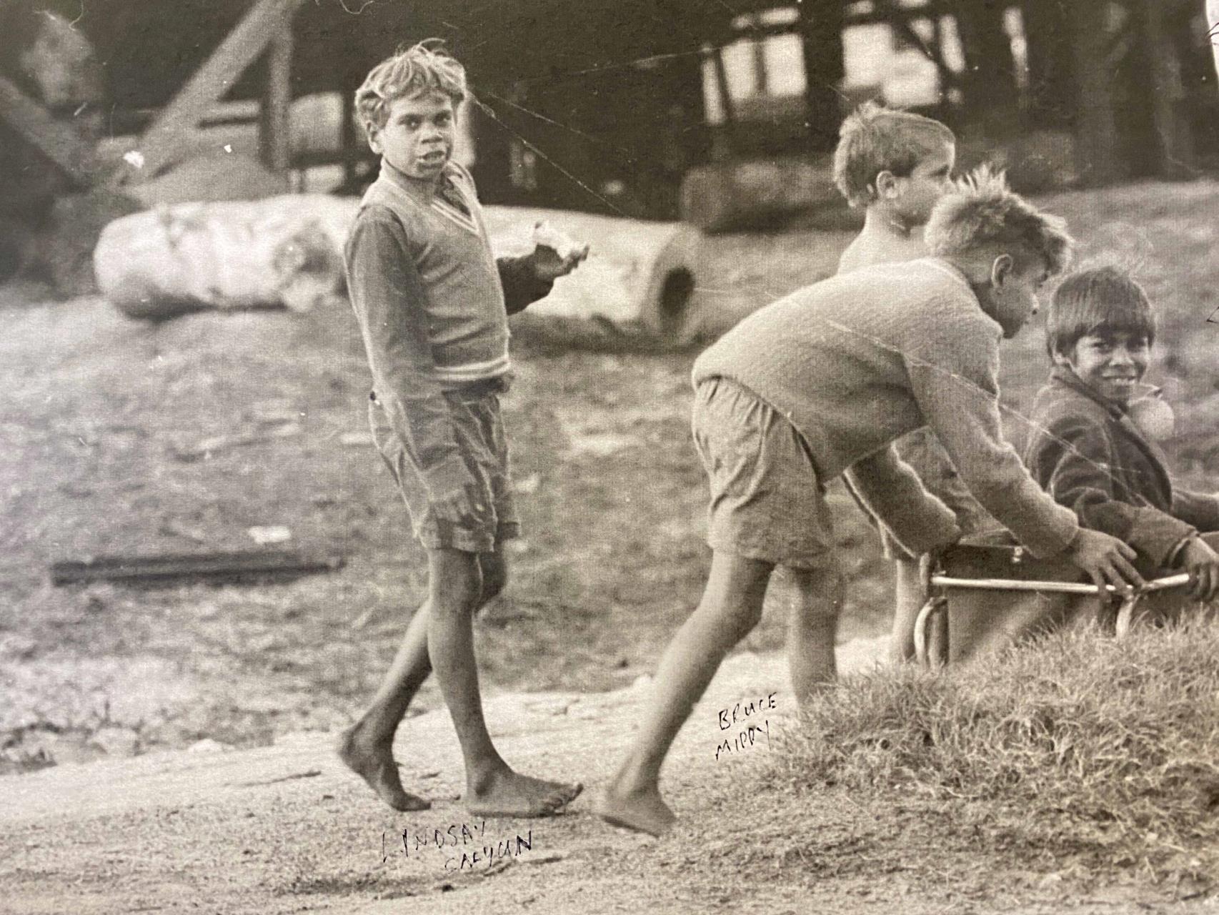
Lindsay Calyun and friends Brucy Mippy, Noel Quartermaine and William Bodney playing at Millar’s Cave, 1965. (©West Australian Newspapers Limited)
East Perth was also important for the Coolbaroo League which operated from 1947 - 1960 as an advocacy group for Aboriginal rights. Coolbaroo dances were held at various locations including Edward Street and later Beaufort Street near Weld Square. Many Coolbaroo League leaders went on to form social welfare organisations that were based in the East Perth area such as: the Aboriginal Advancement Council at 201 Beaufort Street; the Aboriginal Medical Service, formerly at 154 Edward Street (now Derbarl Yerrigan Health Service at 156 Wittenoom Street); and the Aboriginal Legal Service, formerly on James and later Nash Street, East Perth.
By the 1970s, Aboriginal people started moving out of East Perth to outer metropolitan suburbs. Local manufacturing industries (such as Brisbane & Wunderlich of 105 Lord Street) also started leaving the area. The old railway depot closed in 1968 to make way for the new Transport Complex on West Parade, and the East Perth Power Station closed in 1981.
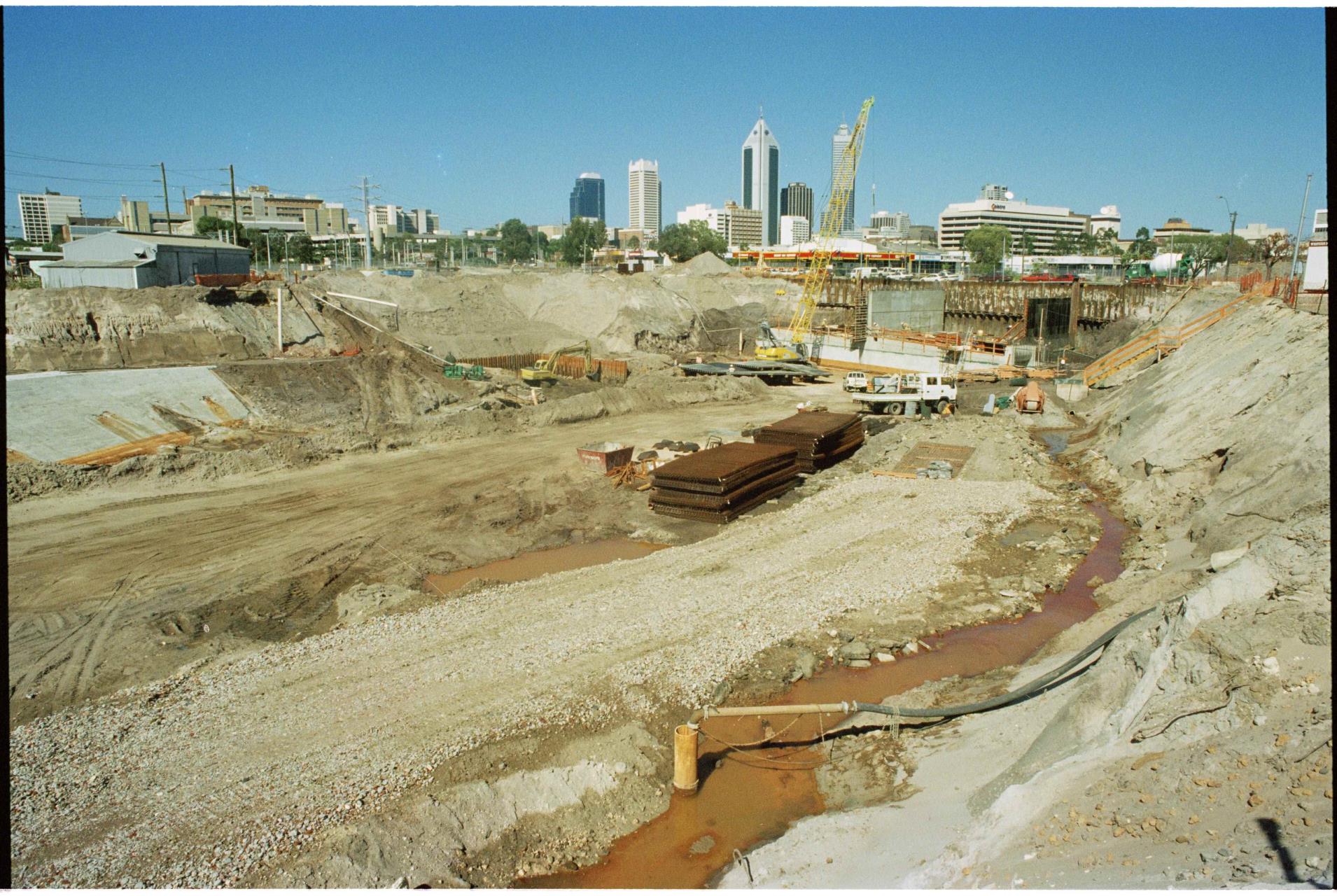
Northbridge Tunnel & Graham Farmer Freeway under construction, December 1997 (SLWA_b4660979_4)
In the 1990s, the Graham Farmer Freeway was constructed to allow for an east-west bypass of the Perth CBD. It officially opened in April 2000 and comprised of the freeway itself, the Northbridge Tunnel and the Windan Bridge. It was named after high profile football star of the 1950s - 1970s Graham ‘Polly’ Farmer, who began his career with the East Perth Football Club. It further cut the East Perth area in half, the northern part which came under the jurisdiction of Vincent, a new council formed after the de-merger of Perth City Council in 1994.
In 1991, the East Perth Redevelopment Authority (EPRA) was established to guide and stimulate the revitalisation of the area. In the following decades, EPRA undertook a number of projects including the redevelopment of the Claisebrook Drain into a canal waterway fringed by residential and commercial buildings. EPRA were also involved in discussions over the future redevelopment of the former East Perth Power Station.
Today, the Perth-East Perth-Claisebrook area (inclusive of both City of Perth and City of Vincent areas) is home to approximately 11,798 people with 7,331 (roughly 60%) resident in the area north of the Freeway that is part of the City of Vincent. Significant portions of the area have undergone gentrification, which is reflected in the higher socio-economic and education indicators for the population (ABS 2021).
East Perth has a rich colonial, industrial and Aboriginal heritage. The area is home to many heritage sites including several registered Aboriginal sites noted for being a Noongar camping and meeting place with a special spiritual connection to the Waugal. The suburb as a whole also holds great contemporary social significance for many Noongar and other Aboriginal people who lived in and around East Perth from the 1950s - 1970s. The Moorditj Footprints project captured some of these stories.
The ‘Mucks’ at Banks Reserve, 1992 (SLWA)
For more great photos of East Perth visit the Local History Image Gallery: East Perth History Album
If you have any further information or photographs of East Perth please contact us at local.history@vincent.wa.gov.au