West Perth
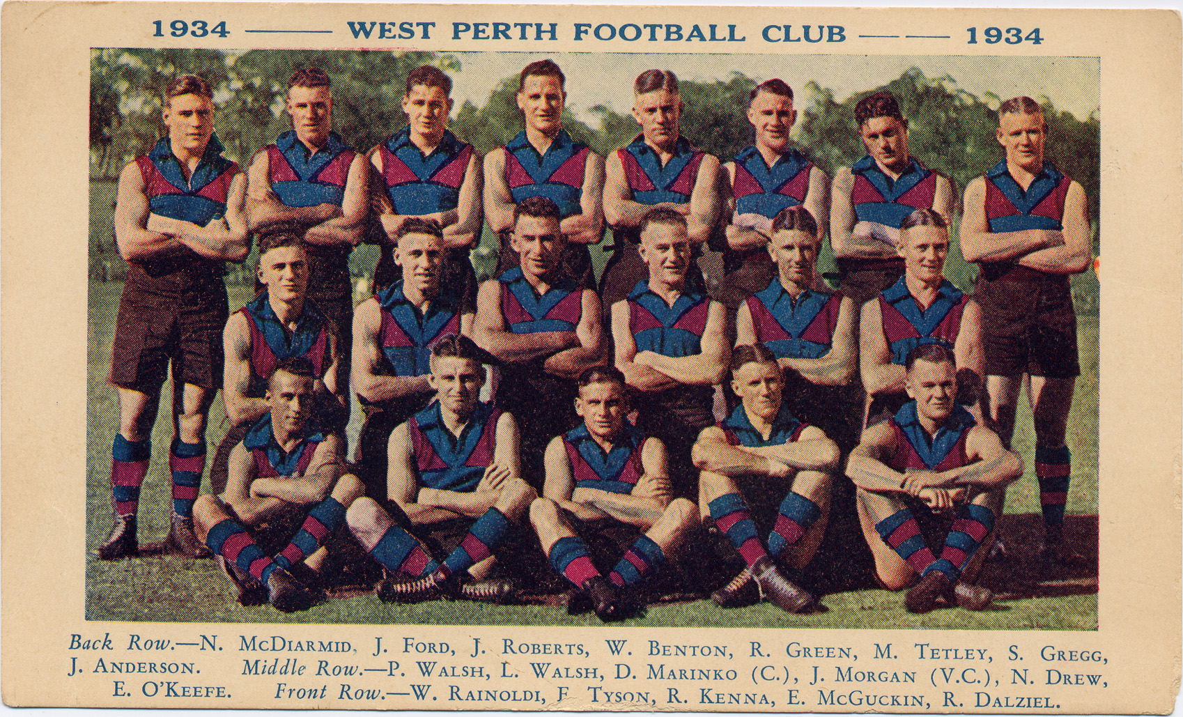
West Perth Football Club, 1934 (COV PHO1820)
West Perth is one of Vincent’s oldest and most diverse suburbs with a mixture of industrial, residential and commercial areas. In the 1970s, it was split by the Mitchell Freeway and since the 1990s has been part of both the City of Perth and the City of Vincent.
Early History
West Perth lies in a chain of seasonal wetlands that were important as food sources and campsites for the Whadjuk Noongar people. The area now known as Dorrien Gardens was once part of Lake Henderson and was known as Goongarulnyarreenup. The present day Robertson Park was also part of the Lake Henderson wetland area known to Noongar as Boojoormelup, which translates in Noongar to ‘place of the eye’ or ‘place where people see or are seen’. In January 1850, a large meeting of over 300 Noongar people was recorded at this site, including Aboriginal people who traveled all the way from Geraldton (Source: Perth Inquirer, 23 January 1850). Photographs and newspaper reports also detail Noongar people camping in the area in the 1860s (Source: Perth Gazette, 22 August 1862).
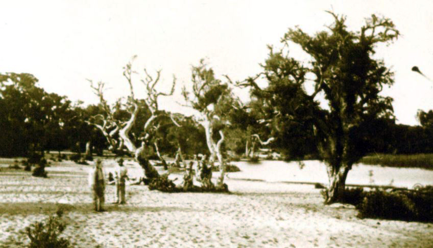
Noongar people at Lake Henderson/ Boojoormelup, January 1864 (SLWA 3451B/1)
Lake Henderson, including some of the Dorrien Gardens section, was drained in the early 1870s. Joseph Gallop purchased some of the reclaimed land on Cowle Street (No.54/Lot Y207) and grew vegetables on the lake bed. Gallop and other market gardeners in Cowle Street were followed by Chinese market gardeners from the 1890s.
1880s - 1940s
The opening of the Perth to Fremantle Railway in 1881 stimulated residential subdivision in the West Perth area. Newcastle Street became one of the main streets largely due to the tram service established along its length linking the West Perth area to central Perth. Most of the houses were built on the north side of Newcastle Street, with a more commercial focus on the south side.
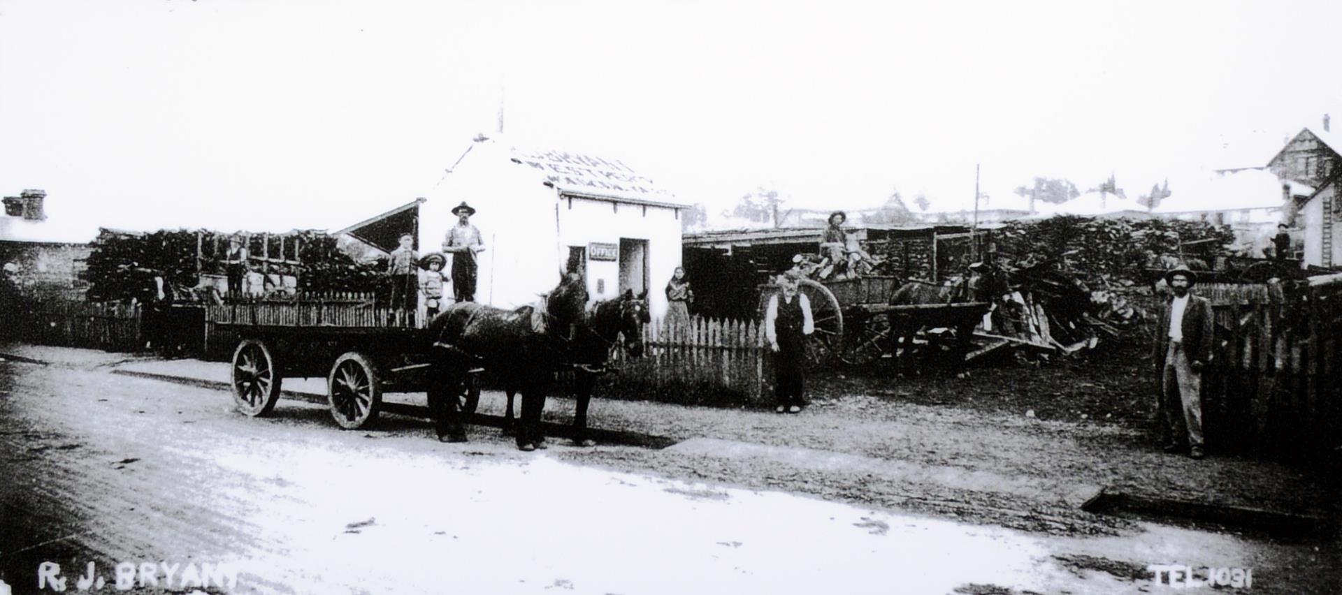
R.J. Bryant’s woodyard on Duke Street (later renamed Aberdeen Street), 1905. (COV PHO6084)
In the 1890s, with increases in population and rising affluence as a result of the West Australian gold rushes, Perth spread northwards. Lots were offered for sale in the area south of Vincent Street and east of Oxford Street, including Carr and Cowle Streets (Location Ax). Smaller blocks were developed in the Florence Street area on which terrace dwellings and worker’s cottages were built. Shops and factories also dotted the area. In the late 1890s, several bakers and a flour milling business set up on Cleaver Street, and Herbert Stone’s box manufacturing company was established in Fitzgerald Street (south of Lawley Street) in 1896. Around the same time, the Commonwealth Hotel (now the Hyde Park Hotel) was built on the corner of Fitzgerald and Bulwer Streets in 1898.
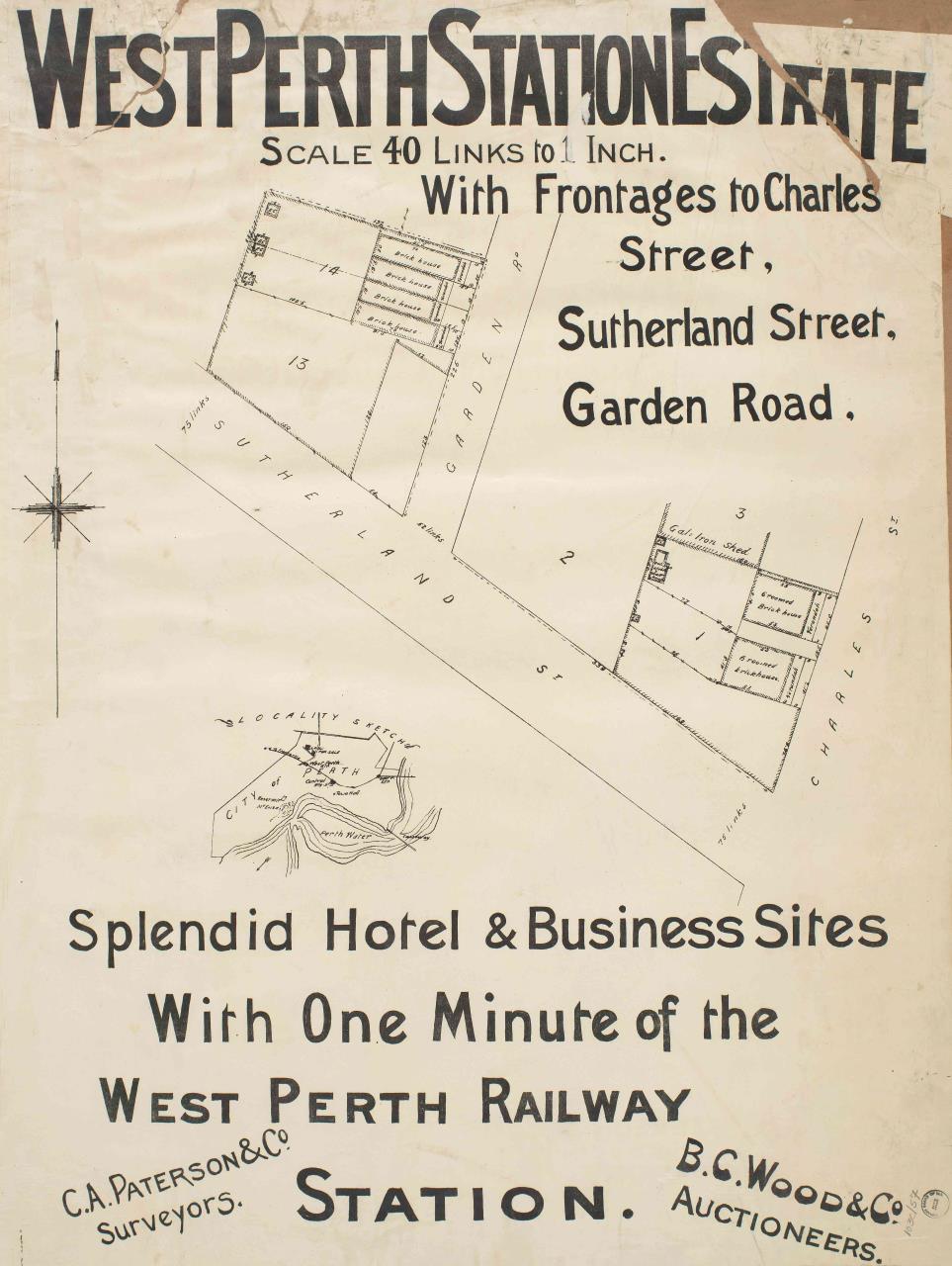
West Perth Station Estate, 1896 (SLWA 33/18/57)
The West Perth area developed rapidly in the 1890s with a mix of industrial, commercial and residential buildings that were accessible via public transport and in proximity to civic amenities such as schools and churches.
St John’s Church of England Day School opened at 480 Newcastle Street in 1890, later renamed the West Perth public school. The school was later known as the Newcastle Street Government School and the Newcastle Street Junior Technical School. It operated until the 1990s and was listed on the Register of Heritage Places as a Permanent Entry in 2001 (Heritage Council Heritage Place 02241).
Around the corner was the Methodist Chapel at 113 Charles Street, built in 1890. This original building became the parish hall for the much larger Gothic style limestone church built in 1896. The Church of England also built a church and presbytery at 125 and 127 Charles Street in 1897 (rebuilt in 1920) which became a Greek Orthodox Church much later in the 1950s.
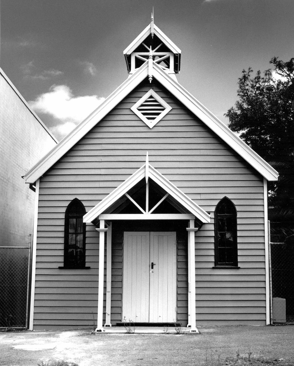
Methodist Mission Chapel, 113 Charles Street West Perth, c.2000. (COV PHO5870)
Nurse Alice Stockley ran a maternity hospital at 47 Newcastle Street in 1911, moving to 590 Newcastle Street in 1913 and renamed the Swan Maternity Hospital. It was the first purpose-built privately owned maternity hospital in Western Australia accommodating up to ten pregnant women at a time. In the 1920s, Nurse Stockley opened a second general surgical hospital at 572 Newcastle Street known as St Anne’s, and later the City West Private Hospital. In 1940, Nurse Stockley closed City West, which was converted to flats. In 1944, she retired and sold the Swan Hospital, which changed its name to the Blaich Appin Maternity Hospital and operated until 1949 when it was bought by the Department of Health and became the Perth Child Guidance Clinic Blaich Appin. The building was heritage listed in 2009, then de-listed and sold by the Department of Health to a private owner in 2011.
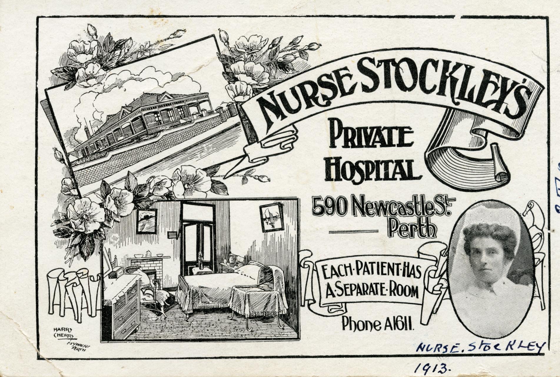
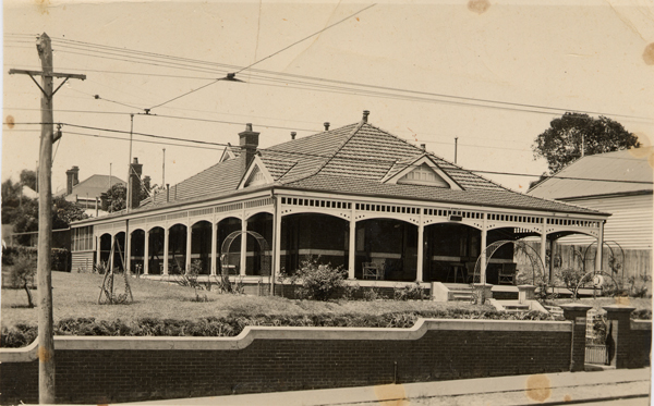
Postcard for Nurse Stockley’s Private Hospital, c.1913 (COV PHO6046) Swan Maternity Hospital at 590 Newcastle Street, West Perth, c.1930s (COV PHO2766)
After WWI, development in the area languished due to the Depression. However, local industries developed along and south of Newcastle Street, including Sandover's Hardware on Newcastle and Golding Streets, as well as several vinegar and pickling factories such as the WA Vinegar Brewery on Golding Street, and the Swan Brand Factory at 567 Newcastle Street which manufactured sauces and pickles from the 1920s to the 1960s.
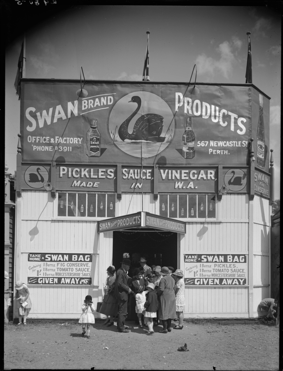
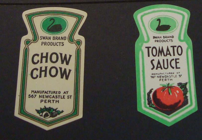
Swan Brand Pickles at the Perth Royal Show, 1929. (SLWA_b1921059_5); Swan Brand Jar labels (COV Ephemera)
In 1913, the Perth City Council purchased the Chinese gardens in the West Perth area to develop new recreation grounds. In 1917, Lake Henderson became Robertson Park and small remnants of Lake Sutherland were integrated into what became Hamilton Park along Aberdeen and Sutherland Streets. During the 1920s, the City of Perth filled in and reclaimed the former wetlands and market gardens to make a children’s playground and recreation reserve with tennis courts, with a tennis pavilion constructed in 1928. Perth City Council bought the cottage constructed in 1903 and occupied by Chinese market gardener Lee Hop and renovated it for use as a park caretaker’s residence in 1928. The 17 tennis courts on Robertson Park were officially opened in February 1929, with the children’s playground opened two years later in 1931. The park also hosted a variety of women’s sports, including hockey and basketball, as well as a children’s library and craft centre, leased by the ‘Little Citizen’s League’ in a small cottage off Fitzgerald and Stuart Streets.
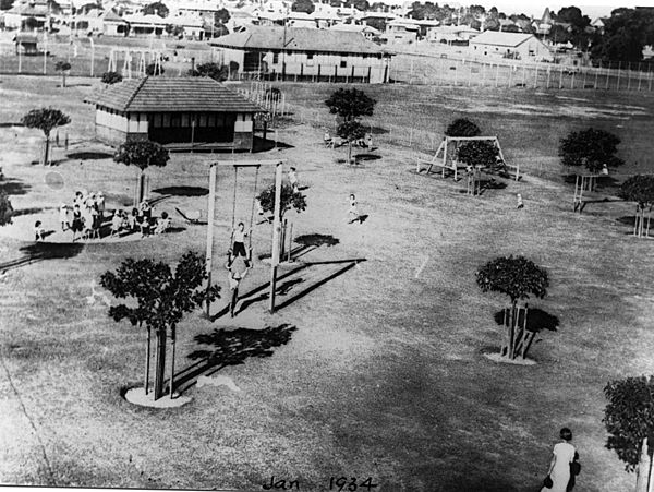
Robertson Park Playground, 1934 (COV PH0367)
Throughout the 20th Century, the southern end of Robertson Park had an industrial history as the location of the former Union Maltings factory and bottle exchange, which operated from 1905-1974.
To learn more about the history of Robertson Park, read Robertson Park/Boojoormelup, Perth: A Pictorial History by Chris Hair and the recollections of local residents Reg Axford & Harold Mundy; Bill Chiew and Elza Hughes.
Across from Robertson Park was the social hub for Perth's Italian community. The Casa D'Italia ('House of Italy') opened at 219-221 Fitzgerald Street in 1937. During the Second World War, the Casa d’Italia was closed and many of its members were interned as 'enemy aliens'. After the war, it resumed activities and was rebuilt and expanded in 1954, and again in 1968.
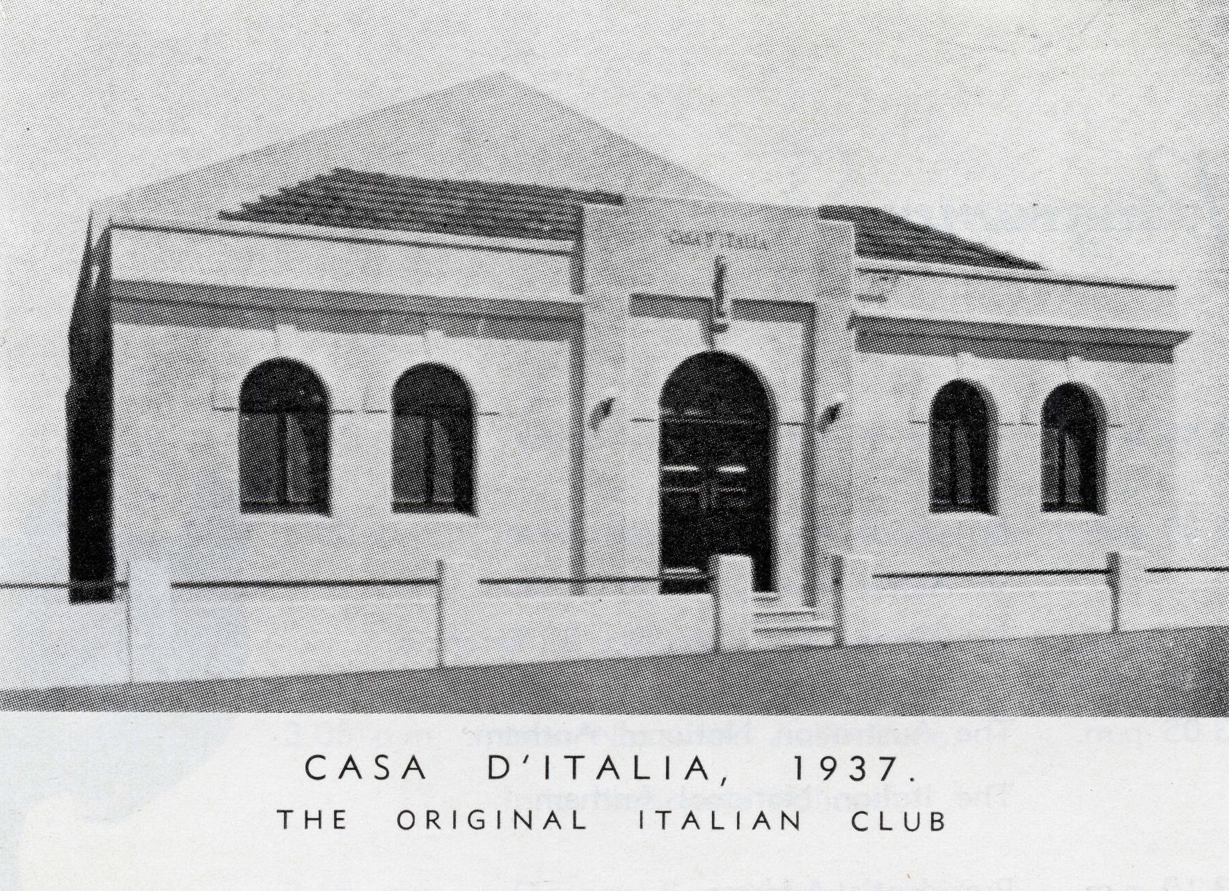
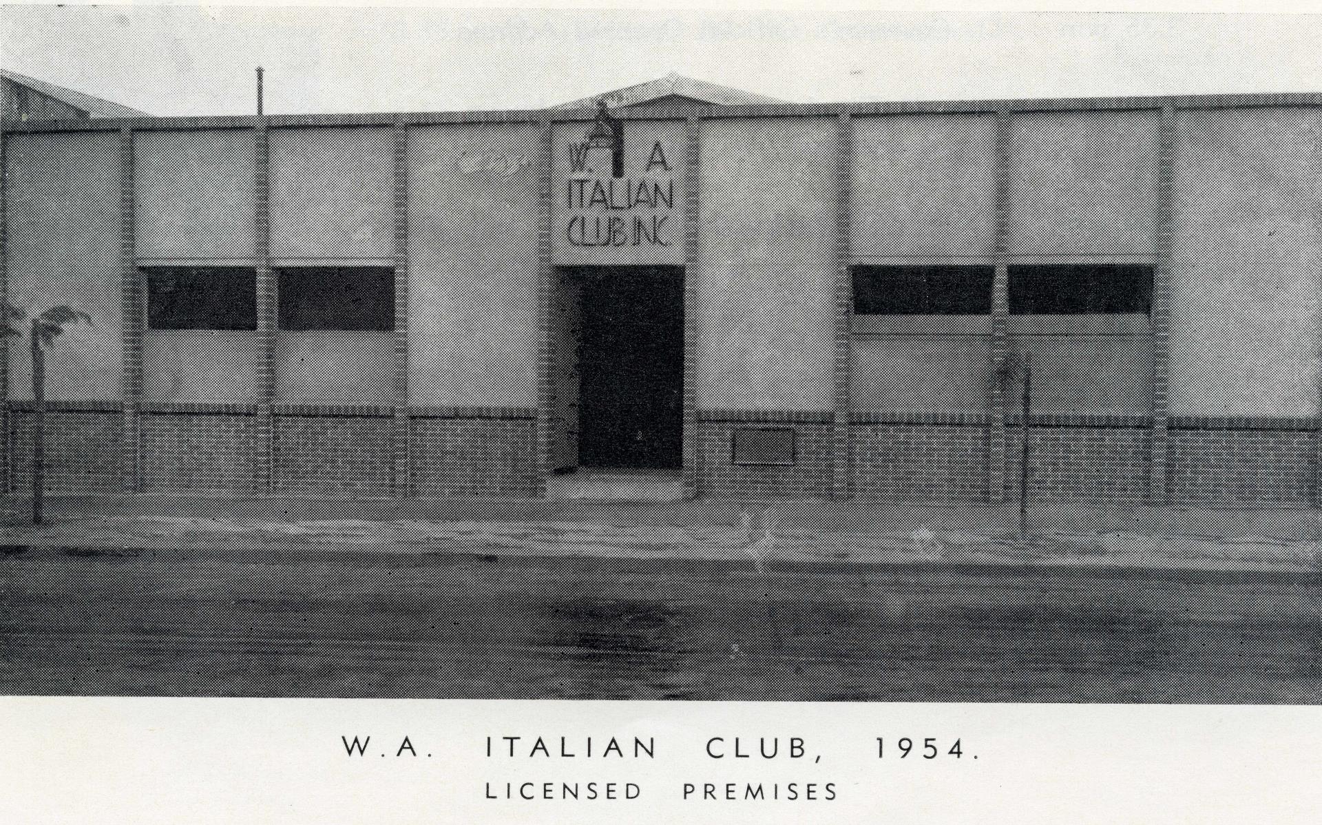
Facade of the original and refurbished Italian Club on Fitzgerald Street, West Perth 1947 and 1954 (COV PH05919 & PH05920)
Post-War
The post-war period brought waves of immigrants and refugees from Europe and the transformation of single residences into multiple dwellings and flats to accommodate the growing population. Clubs and social institutions sprang up or grew reflecting the increasingly diverse residents in the area. The WA Italian Club expanded in the 1950s and became the centre of sporting, social and cultural life for Italian migrants in Perth. It also became a hub for a variety of sub groups including the Azzurri Soccer Club, based at Dorrien Gardens adjacent to the WA Italian Club. Across the road in a small cottage that had been a former children's library on the corner of Stuart Street and Robertson Park, was the WA Italian Club's Italian Language School run by the Ursuline Sisters from the 1960s until the early 1970s.
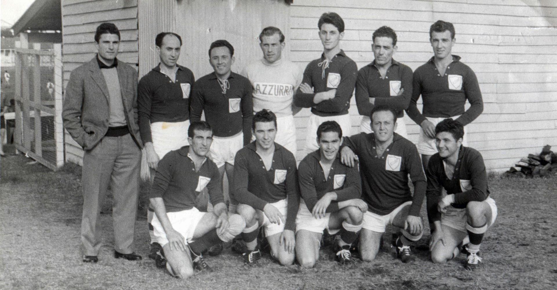
Azzurri Soccer Team at Dorrien Gardens, West Perth, 1948 (COV PHO5933)
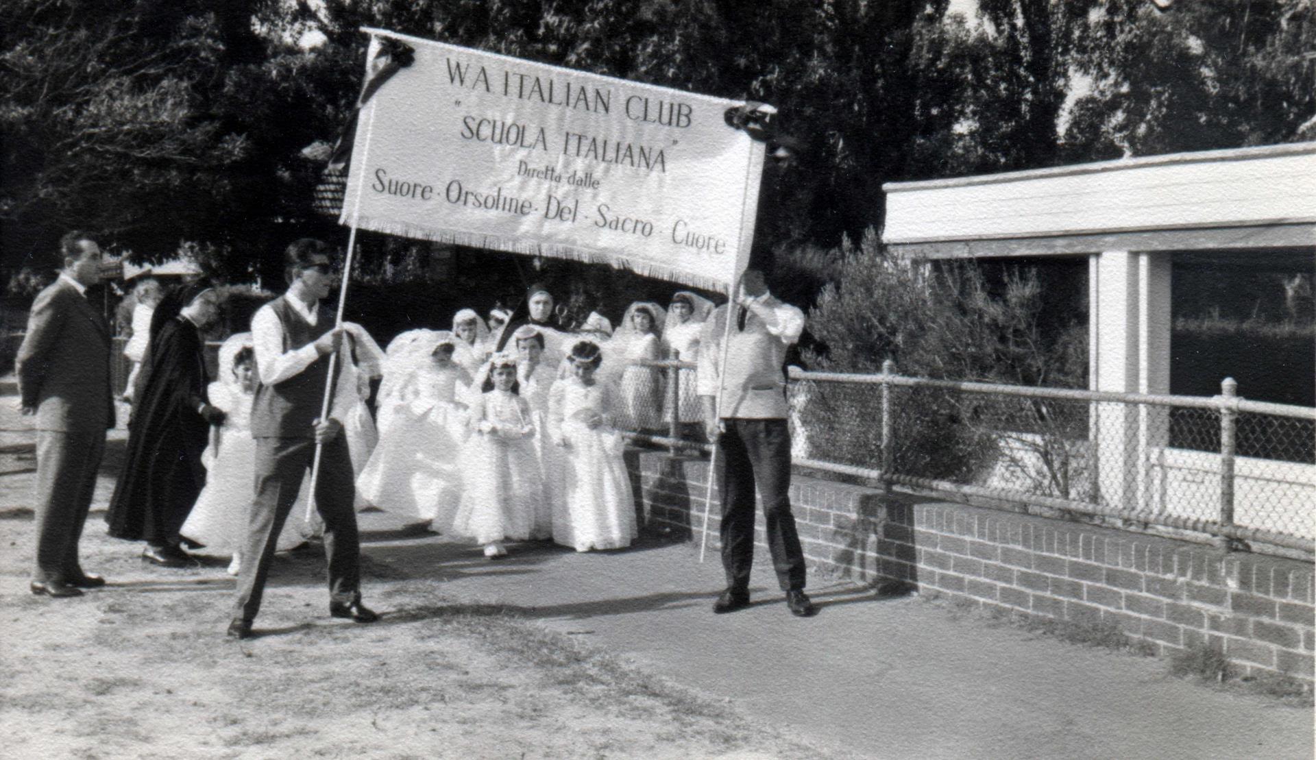
Italian language school students in their first communion dresses outside the school at 170 Fitzgerald Street, 1962 (COV PHO5936)
Apart from Italians, Greek migrants also had a major impact on the West Perth area after WWII. In 1958, the Greek Orthodox community bought the former St Paul’s Anglican Church and presbytery on Charles and Carr Streets and reconsecrated it The Greek Orthodox Church of the Annunciation of Our Lady Evangelismos.
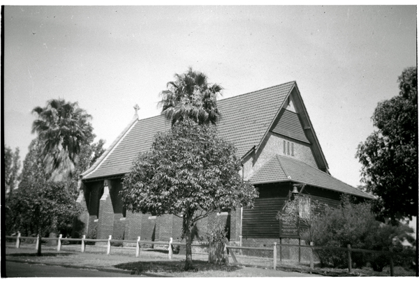
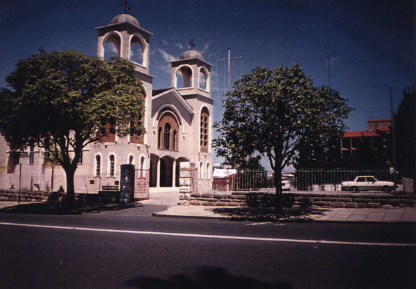
St Paul’s Church, 59 Car Street West Perth, 1953 (COV PHO3051) Greek Orthodox Church, 59 Carr Street West Perth, 1970s (COV PH01052)
From the 1950s and 1960s commerce and industry grew further, developing into a significant light industrial zone particularly south of Newcastle Street. Shortages of business premises also meant homes, stables and old sheds were converted for retail outlets, workshops and small factories.
In the 1970s, construction of the Mitchell Freeway affected the area when the lower end of Charles Street became an on/off ramp for Freeway traffic. While the Freeway itself formed a physical barrier at the south-western edge of the suburb, this new link gave West Perth residents easy access to the Narrows Bridge and the southern suburbs.
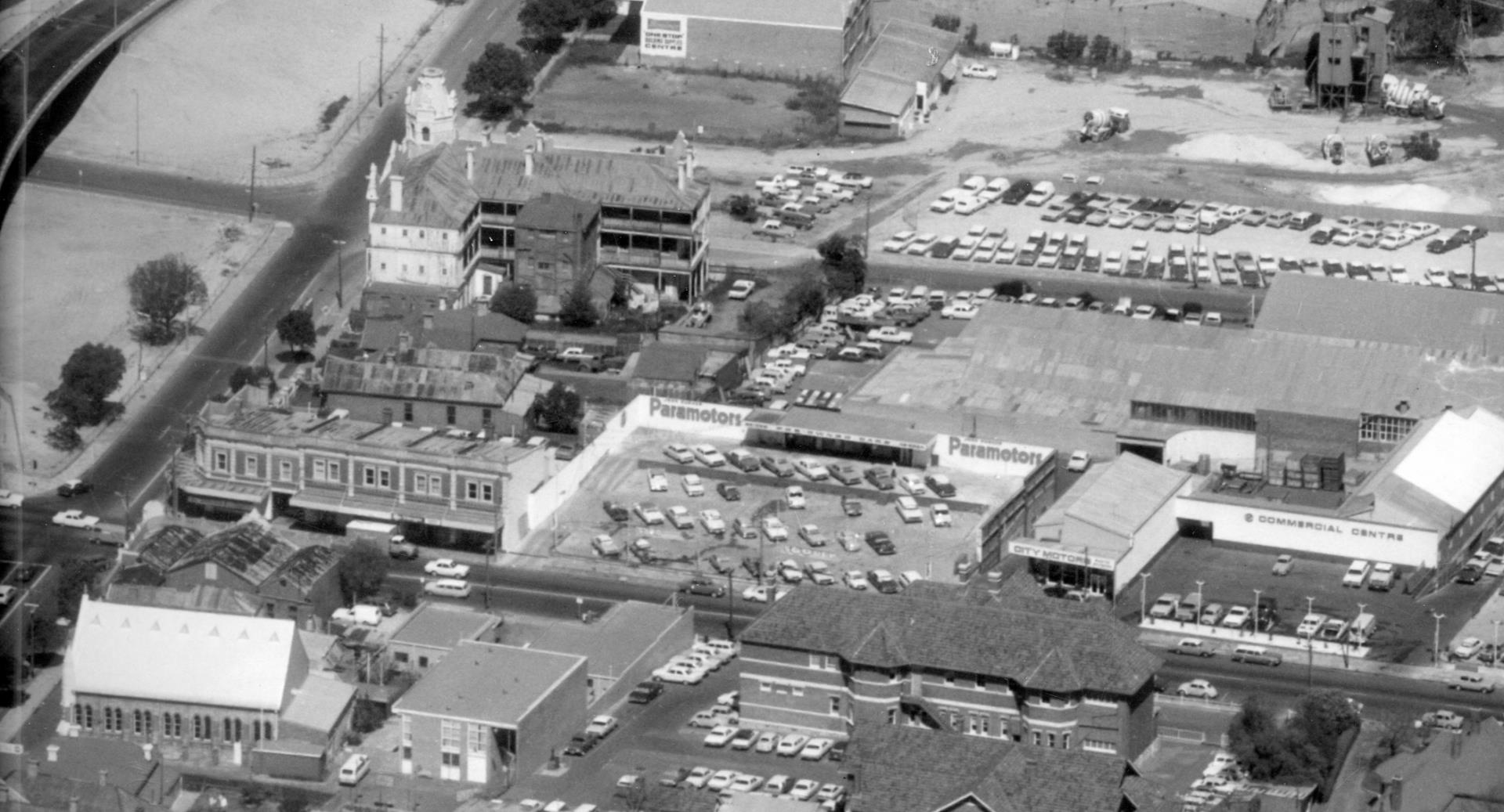
Aerial view of Newcastle and Charles Street intersection, 1972 (COV PHO3271)
Although the area north of the Mitchell Freeway was geographically split off from the City of Perth, it stayed within the city’s governance boundary until the establishment of the Town of Vincent in 1994. Local government jurisdiction over West Perth was subsequently split between the City of Perth (responsible for the area south and west of the Mitchell Freeway, east of Thomas Street and north of King’s Park Road) and City of Vincent (north of Mitchell Freeway, south of Vincent Street, east of Charles Street and west of Loftus Street).
In the 2000s, the construction of the Graham Farmer Freeway and tunnel in 2000 and its links with the Mitchell Freeway led to the widening and upgrading of Loftus Street. Some of West Perth’s homes and businesses were demolished to make way for construction. The area north of Newcastle Street saw the development of high density apartments and townhouses with retention of some of the original housing, including the heritage protected Hummerston Lodge at 67 Cleaver Street, which has been preserved at the centre of a large residential aged care development built in 2020 (Rosewood Aged Care).
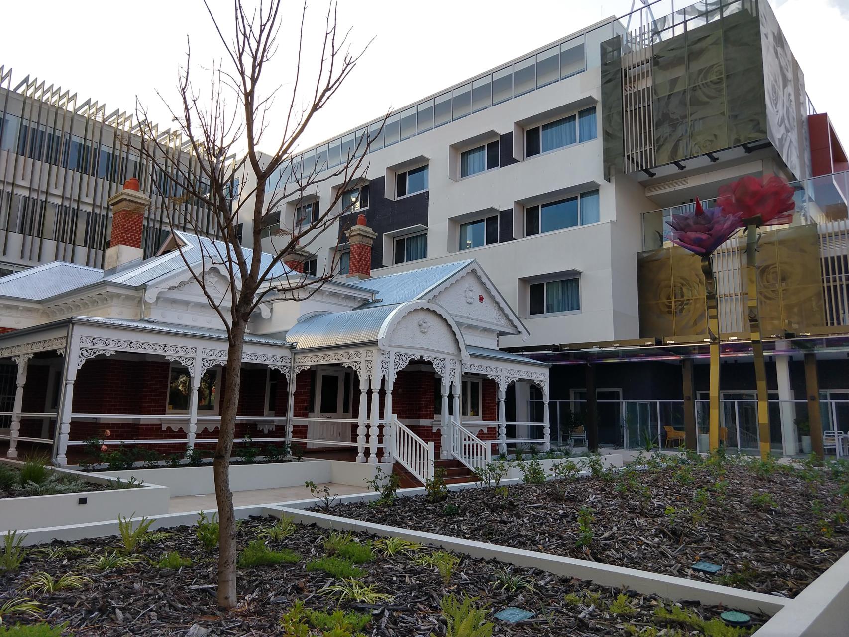
Florence Hummerston Lodge at Rosewood Aged Care, Cleaver Street West Perth, 2022.
In 2021, the Cleaver Street precinct (which includes Strathcona, Florence, Hammond, Ivy Streets and Prospect Place) was successfully nominated as a ‘Character Area’ with design guidelines that encourage retention and renovation of character in the area (COV Council Briefing Agenda 7 Dec 2021). The area south of Newcastle Street has been revitalised as an arts precinct branded ‘the Pickle District’ in a nod to its former industrial heritage of pickle and vinegar manufacturers.
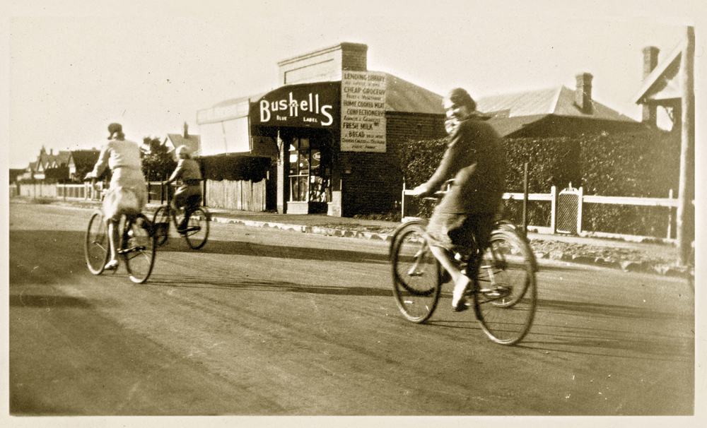
Cyclists on Cleaver Street, West Perth, 1920s (COV PHO3362)
For more great photos of West Perth visit the Local History Image Gallery: West Perth History Album
If you have any further information about or photographs of West Perth please contact us at local.history@vincent.wa.gov.au