Nidja Noongar boodjar wer wangkiny
This is Noongar land and stories.
The City of Vincent is located in a chain of seasonal wetlands between the coast and Swan River which have practical, social and spiritual significance to the Whadjuk Noongar people, the traditional owners and custodians of the area for at least 45,000 years.
Long before British colonisation, the extensive wetland system north of Perth was crucial to Noongar life. Much of the Vincent area was built over and around a chain of seasonal wetlands connected to the Swan River. Most of these wetlands were drained or filled from the 1850s onwards and are no longer visible today. However, their footprint endures in the various parks and reserves across Vincent, many of which are located on or around former swamps of the wetland chain.
There are several places with special relevance for Noongar heritage in North Perth.
Dog Swamp – Registered Aboriginal Site 3738
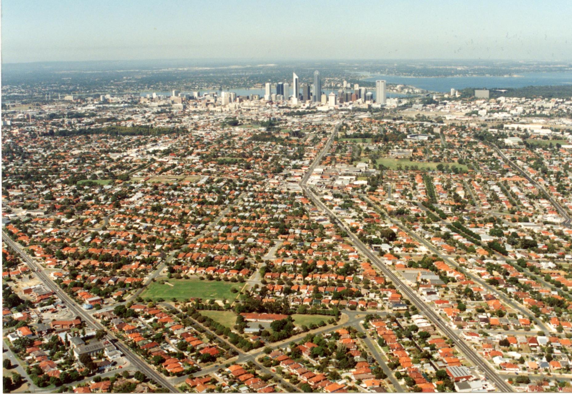
Aerial view of Perth showing North Perth and Dogswamp area in foreground, 1989 (COV PHO6316)
The area now known as Dog Swamp, which includes the northern-most part of North Perth near Kyilla School, has significance as a mythological site relating to the the Waugal, the water snake Noongar people recognise as responsible for the creation of the landscape during the nyitting (cold times). It is also recognised as a former ochre quarry. Sam Broomhall, an Aboriginal man from Broome who settled near Lake Claremont, quarried wilgie (red ochre) on the north-eastern side of the swamp.
The fresh water pools were also an occasional camp and water source for Noongar journeying to and from the meeting ground at Yanchep or hunting and foraging in the chain of fresh water lakes that lie alongside the present day Wanneroo Road.
Historical records show that Noongar men Gilbert Harris and Bonnie Layland camped on the south-east side of Dog Swamp (around present-day Flinders Street/Wiluna Street) until the 1940s. Bonny Layland regularly travelled from his camp near Dog Swamp to fish for turtles in Lake Monger/Galup in the 1940s.
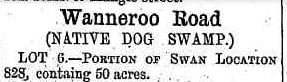
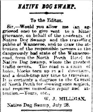
In the late 19th and early 20th Centuries, the area was known as ‘Native Dog Swamp’ and newspapers reported Aboriginal people camping or living in the area.
The names of Dog Swamp and the suburbs of Yokine and Mt Yokine have a common origin: Yokine in Noongar means 'native dog', and Dog Swamp was originally referred to as Native Dog Swamp.
The Daily News, 13 October 1885.
The West Australian, 1 August 1904.
In 1944, Aboriginal man James Egan of Dog Swamp was sentenced to imprisonment for having breached the Perth Prohibited Area without a permit.
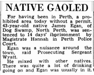
The Daily News, 7 January 1944.
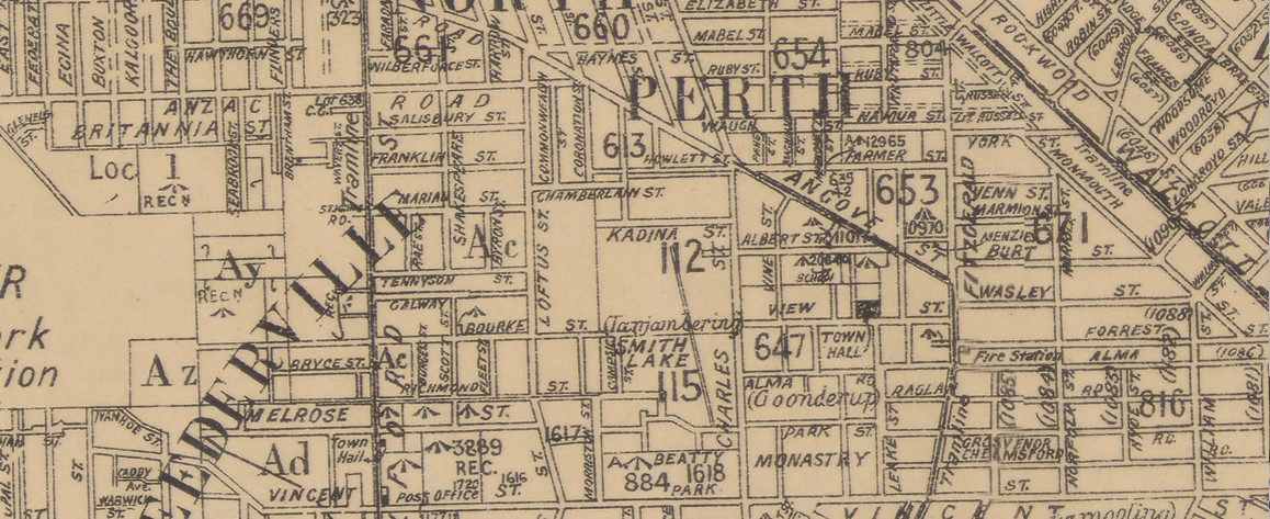
Danjanberup/Janjanbering/Smith’s Lake
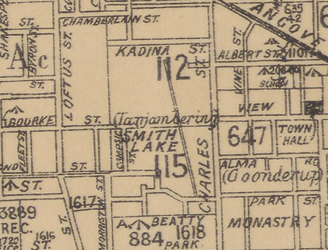
Cropped excerpt from map of Perth 1933, (SLWA CN77 40 Chain)
Danjanberup/Smith’s Lake is recognised for its Noongar heritage as a ‘meeting place’ by the Department of Planning Lands and Heritage under its Aboriginal Heritage Inquiry System (‘Other Heritage Place 3572’).
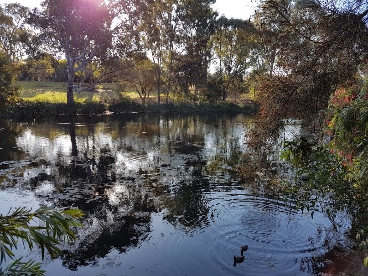
Smith’s Lake, 2020 (COV PHO 6503A)
Anthropologist / journalist Daisy Bates recorded the site of ‘Janjanbering’ in the vicinity of ‘Monger’s Lake’ near a source of ochre, which was a highly prized and tradeable commodity for Noongar people. The name later appeared on official public works department maps from the early 1900s until the 1930s.
In a 2021 workshop held by the City of Vincent, Noongar Elders decoded the name ‘Danjanberup’ as meaning footpath or pathway to the digging place, possibly referencing its proximity to either the ochre or food sources near Lake Monger/Galup. 'Dan' meaning many; 'djan' meaning foot; 'ber'/'beriny' meaning to dig, scratch or scrape; 'up' meaning location.
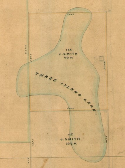
Excerpts from map of new allotments in Perth, 1858-1860 (SRO Cons_3868_item301)
European colonists named the area ‘Three Island Lake’ (because three islands rose out of the south-western edge of the lake) and later ‘Smith’s Lake’ after local farmer John Smith, a discharged Sergeant who was granted land at Three Island Lake in 1840.
The area of the lake gradually diminished as it was drained and developed for farming and market gardening in the 19th and early 20th centuries. After WWII, the land was resumed for residential subdivision and recreation and Charles Veryard Reserve was established over much of the former lake bed.
In the late 1990s, the Smith's Lake Precinct Group coordinated efforts to rehabilitate the former lake and wetland. In 2002, planting, artworks and signs were installed allowing visitors to read and hear different stories about the significance of the wetland area from Noongar, British and Chinese perspectives. The ‘talking rock’ installation includes the voice and words of the late Noongar Elder Doolann-Leisha Eatts who recounts a story passed down to her by her ancestors about early colonial contact and conflict in the area. (For more information about Doolann’s story visit the Galup website).
The sculpture by artists Ngardarb Francine Riches & Tony Riches depicts a campfire and references the importance of Aboriginal storytelling. Musician Dan Riches, son of the artists, performed at Smith’s Lake for Reconciliation Week in 2020 and discussed his connection to the artwork and area.
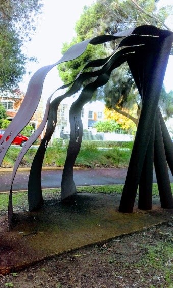
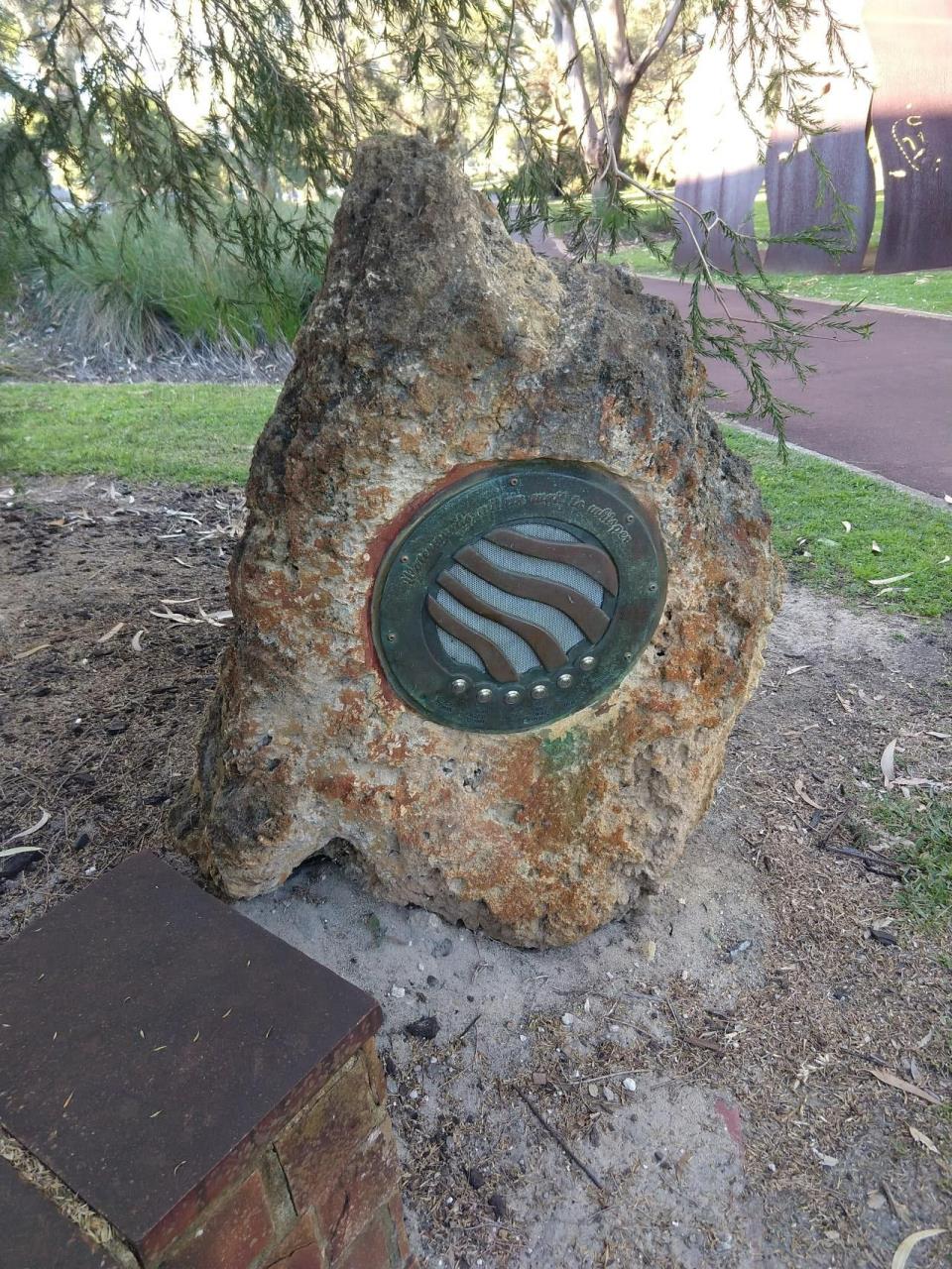
Left: Sculpture at Smith’s lake by Tony Riches and Ngardarb Francine Riches commissioned in 2003 by Town of Vincent, 2022.
Right: Talking rock at Smith’s Lake, 2022.
Video of Dan Riches performing at Smith’s Lake, 2020.
Goonderup
Cropped excerpt from map of Perth, 1933 (SLWA CN77 40 Chain)
Goonderup is recognised for its Noongar heritage by the Department of Planning Lands and Heritage under its Aboriginal Heritage Inquiry System (‘Other Heritage Place 3434’).
The name ‘Goonderup’ refers to the general area around the Redemptorist Monastery. The name was shared by Noongar woman Fanny Balbuk with journalist/anthropologist Daisy Bates in the early 1900s.
The name ‘Goonderup’ appeared on old survey (or ‘chain’ maps) of Perth, which included Noongar names recorded by Daisy Bates. The name was later adopted in 1944 by North Perth State School, who named their school oval ‘Goonderup Place’. The meaning of Goonderup is unclear, but has been variously interpreted as referencing a ‘goonder’ (a bag for carrying infants) (The West Australian, 5 May 1945); or as a place where edible bulbs and roots grew (The Western Mail, 4 July 1929); or as a toilet place (‘goon’ = poo in Noongar; 'up' = location of) (Place Naming Workshop with Boordiya Elders, City of Vincent, Feb 2021).
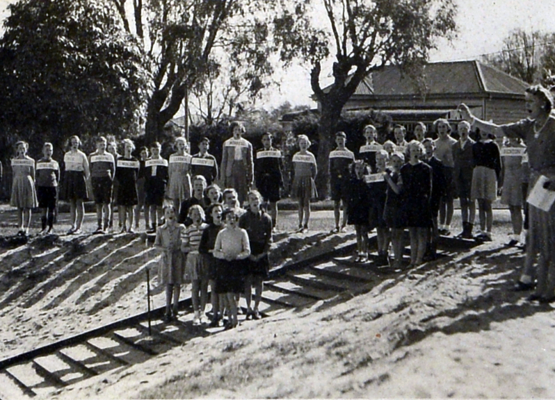
Students at the official opening of Goonderup Place, North Perth 1944 (COV PHO6152)
Albert Street
Albert Street in North Perth is recognised for its Noongar heritage as a place where artefacts have been found (‘Other Heritage Place 3162’).
In the 1970s, two artefacts were found at the site which is close to the Goonderup site and beside the North Perth Primary School. The small number of artefacts relative to other sites in the Vincent area indicate it may have been a place of minor use by Noongar people.
Sources
Harrison, R. 2000. Report on an ethnohistorical investigation into the Aboriginal heritage of the Town of Vincent. Town of Vincent.
O’Connor, R., Bodney, C., Little. L. 1989. Report on an Investigation into the Aboriginal Significance of Wetlands and Rivers in the Perth-Bunbury Region. Leederville: Australian Water Resources Council. (Dogswamp 3.2.5 Page 28).
Department of Planning, Lands & Heritage, Aboriginal Heritage Inquiry System: Registered Aboriginal Site 3738. https://espatial.dplh.wa.gov.au/AHIS/index.html?viewer=AHIS
Department of Planning, Lands & Heritage, Aboriginal Heritage Inquiry System: Other Heritage Place 3434. https://espatial.dplh.wa.gov.au/AHIS/index.html?viewer=AHIS
Department of Planning, Lands & Heritage, Aboriginal Heritage Inquiry System: Other Heritage Place 3572. https://espatial.dplh.wa.gov.au/AHIS/index.html?viewer=AHIS
Department of Planning, Lands & Heritage, Aboriginal Heritage Inquiry System: Other Heritage Place 3162. https://espatial.dplh.wa.gov.au/AHIS/index.html?viewer=AHIS
Hallam, Sylvia, Prehistoric Aboriginal Populations on the Swan Coastal Plain, Western Australia, 1986.
‘Oldest Perth: The Days Before the White Men Won by Daisy Bates’, The Western Mail, 25 December 1909, p 16.
‘Aboriginal Perth’ by Daisy M Bates, The Western Mail, 4 July 1929, p 70.
Eatts, Doolann Leisha, 2014. Doolann: Ngullah Boodjah Ngaadj Nyungah Myah, Our Country, my Nyungah Home. Perth: Optima.
Green, N. 1984. Broken Spears Aborigines and Europeans in the southwest of Australia. Cottlesloe: Focus Education.
Video of Dan Riches performing at Smith’s Lake, 2020. https://www.youtube.com/watch?v=eVxnz6B5PGk_
City of Vincent, Place Naming Workshop with Boordiya Elders facilitated by Moodjar Consultants, 17 February 2022.
Same Drum. (2022). Galup. Retrieved from Same Drum: https://www.samedrum.com/galup
Collard, L. (2007). 'Wangkiny ngulluck Nyungar Nyittiny, boodjar, moort and katijin: talking about creation, country, family and knowledge of the Nyungar of south-western Australia'. In Sally Morgan et al., Speaking from the Heart: Stories of Life, Family & Country (pp. 279-298). Fremantle Arts Centre Press.
Collard, L & Jones, T. (2014). Karla Yarning: This City is Whadjuk Country. Retrieved from City of Perth: https://heritageperth.com.au/karla-yarning-maps/